Day 0 – Arrival in Oban 26/5/24
As usual we drove north to Oban in stages. On the final drive, we planned to drive up from Edinburgh which is a drive of approximately 3 hours. We woke to rather heavy rain, and loaded up the car with panniers and the tandem in a spell of lighter rain before setting off. It continued to be very wet driving from Edinburgh along the M9 – see the video below, which includes the sight of the famous Kelpies statues.
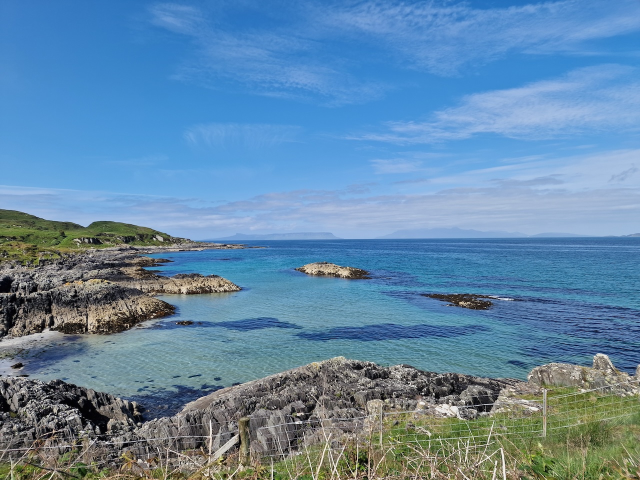
Fortunately the weather got brighter the further west we got, and it was quite nice in Oban. Here's a picture taken en route with the clouds lifting.
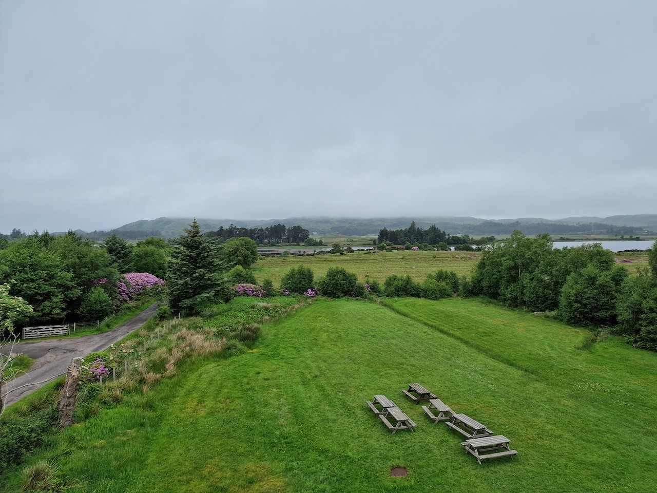
 We arrived at the King’s Knoll Hotel about 3pm and checked in. This was an older building and seemed to be going through a renovation. Our room was really quite nice, but breakfast wasn’t provided. We went into town to buy a few things, including a couple of pots of instant porridge for the following morning’s breakfast.
We stopped to have a coffee and chatted to a German couple, while the rain came on outside. Then we wandered back to the Hotel in rain.
I’d booked dinner at Ee-Usk, a seafood restaurant at the harbour. We had last been there about a decade ago. We had possibly the best table, with lovely views across the harbour and to the nearby small islands. The food was excellent – I had scallops and chorizo for starter followed by a plate of langoustines, while Carol had smoked haddock chowder then scallops as a main course. The food was excellent.
The rain had come on once again while we were eating, but the forecast for Monday and Tuesday had improved a fair bit.
Day 1 – Out to Barra 27/5/24
After getting up and checking our touring baggage, and having some breakfast (instant porridge and a pain au raisin), we drove the car (with the tandem etc) down to Stoddarts for storage. We assembled the bike and piled on the luggage. The bike handles really nicely when loaded, so there were no issues riding down to the Caledonian MacBrayne terminal by the harbour. By the time we’d set up the bike, the early drizzle had stopped.
We got a coffee from the cafe attached to the CalMac terminal and contemplated the upcoming trip. We were booked on the 1310 ferry to Castlebay, due to arrive there at 1755. We had a bit of time to kill, which we occupied by watching various ferries come and go and buying sandwiches from one of the seafood shacks (one smoked salmon and one crab) to eat on the ferry.
Since we last used CalMac ferries on a cycle tour, technology has moved on. Back then, we’d wander down to the ticket desk and buy an Island Hopscotch ticket, essentially a book of open tickets corresponding to a series of ferry crossings typically used by someone on a tour. This was a very flexible ticketing arrangement. Nowadays one is encouraged to buy tickets in advance, specifying the date and sailing along with the number of passengers and what kind of vehicle you’re travelling with. Generally I think this is geared to those with motor vehicles, but is does reduce the flexibility for cycle tourists, particularly those with no fixed itinerary. It does make the check in procedure a bit quicker, with no annoying boarding cards to be filled out – they scan the e-ticket before boarding.
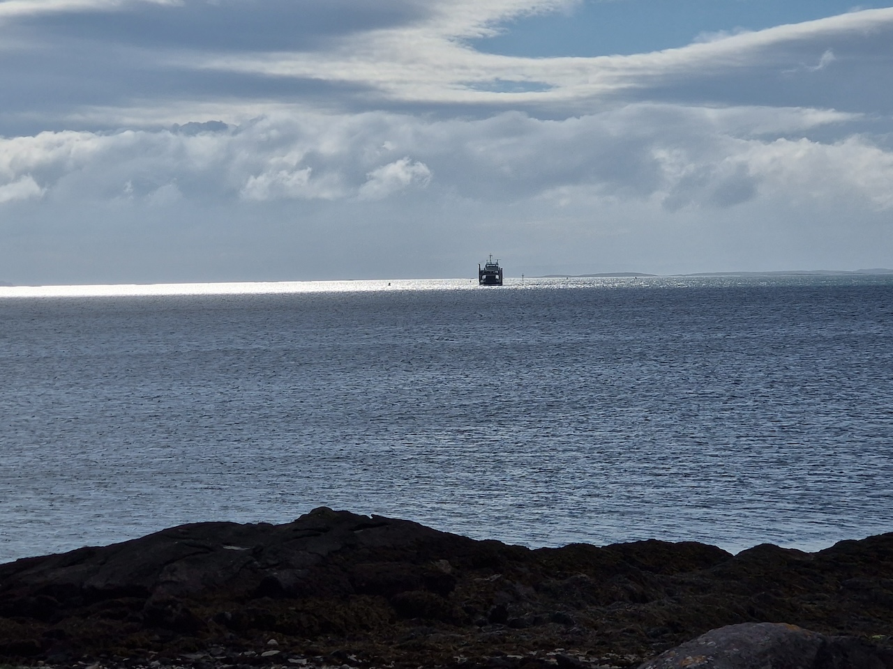
Bikes boarded the ferry first, which meant we could grab some good seats once aboard! It was pretty heavily overcast with occasional rain as we left Oban and sailed up the Sound of Mull and out to sea past Coll and Tiree to one side and Rum to the other.
Rather grey and drizzly weather on the Sound of Mull
Eventually the gloomy drizzly weather lifted a bit and the sun broke through.
The clouds lifted once we were beyond the Sound of Mull
There were about 16 cyclists on board, which seemed quite a lot for the time of year, probably owing to the publicity around the Hebridean Way route, which takes cyclists from Vatersay to the Butt of Lewis.
There are loads of websites describing the Hebridean Way - for example:
Over the last 30 years we’ve taken our tandem to the Outer Hebrides on many occasions, and I do think that to describe it as an “adventure” or a “challenge” is perhaps a bit over the top. There are two routes, one for cyclists and one for walkers (which ends in Stornoway rather than the Butt of Lewis) - I reckon the walking route would be far more of a challenge!
On the other hand, some of the cycle tourists we chatted with had been out touring for 5 weeks or more!
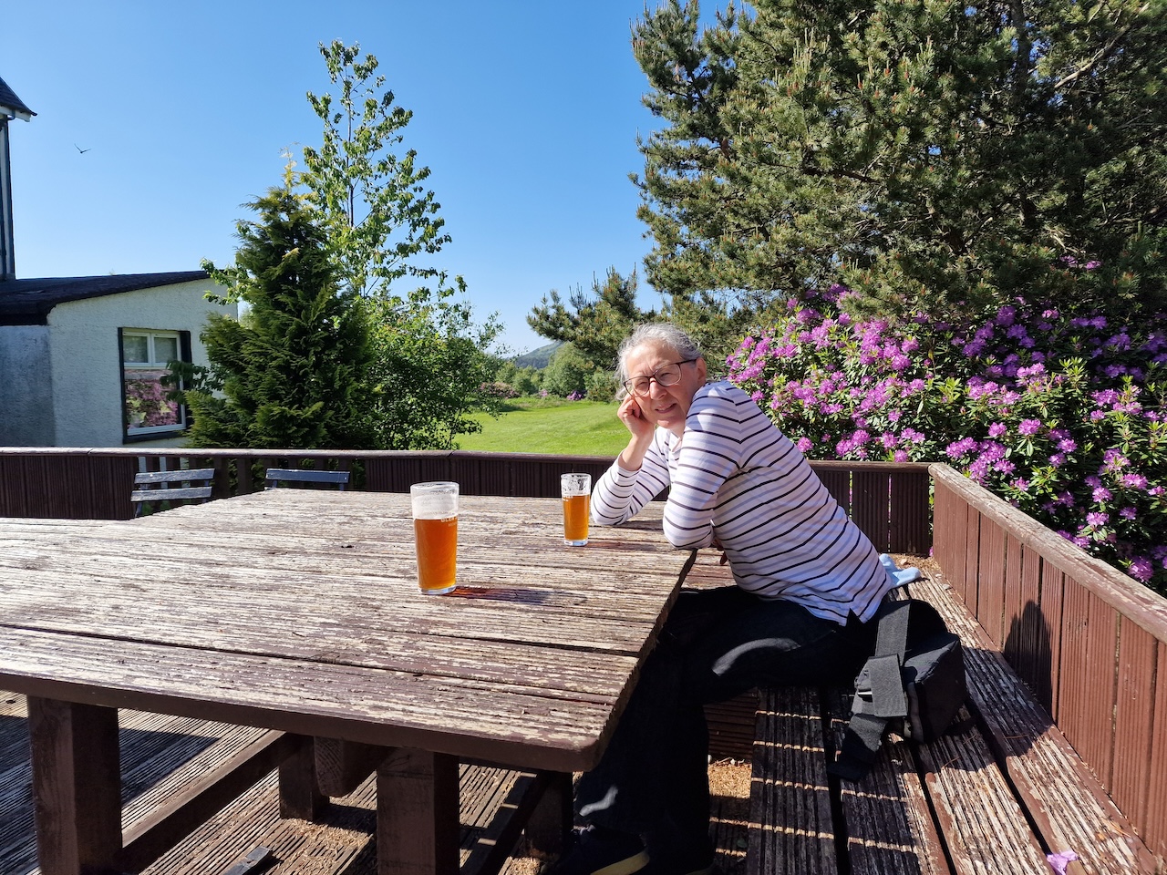
By the time we arrived in Castlebay, it was gloriously sunny. We rode the short distance to the Bayview Guest House, about a mile, where I’d booked two nights’ accommodation. We unloaded our kit and had a quick coffee. Then we walked into Castlebay for a beer at the hotel bar - a very nice IPA – Coast to Coast from Caledonian Brewery - before heading back to the B&B.
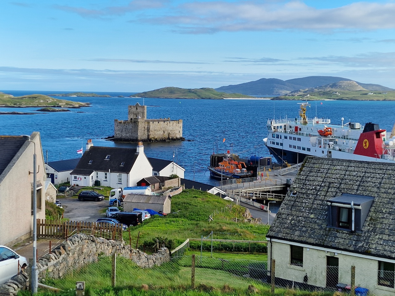
Walking into Castlebay - the castle somewhat dwarfed by the ferry
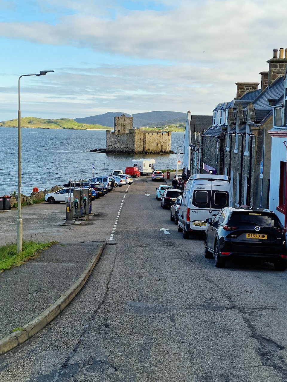
The castle in the bay
On the way back to the B&B, we walked along the Herring Walk, which had some nice installations on it. I get the impression from websites that this is still in development. I particularly liked the large circular mosaic shown below.
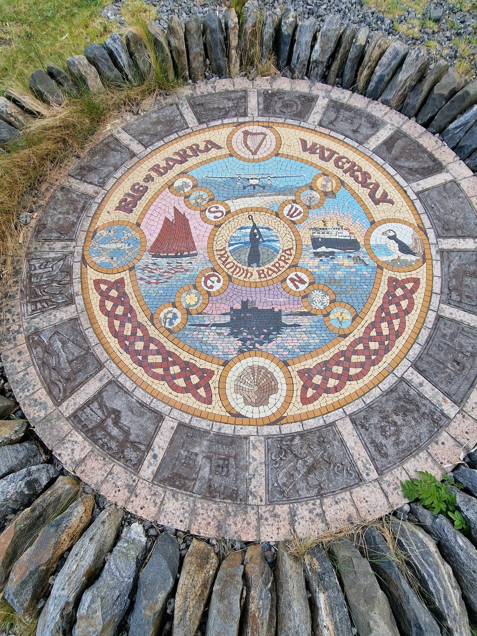
Mosaic on the Herring Walk
We did notice several of the cyclists from the ferry crossing heading down to Vatersay in the evening, presumably to begin their Hebridean Way journey, before returning to their accommodation.
Nature points – hooded crow, cuckoo
Day 2 Barra Tuesday 28th May
I slept well and woke to sunny spells but drizzly rain came on. Today we planned to potter around on Barra, but given the forecast (very heavy rain in the afternoon), we weren’t sure how much cycling we’d actually do.
In the end, we decided to cycle down to Vatersay, and then to head for the airport and maybe take in a snack lunch somewhere.
It was pretty heavily overcast when we set off for Vatersay straight into a steep 12% climb from the B&B! Once over that, the cycling was a bit easier – over the hill and down to the Vatersay causeway. One story I have read says that the Vatersay causeway was built after a prize bull named Bernie was drowned while being taken between Barra and Vatersay. I’ve no idea if that is true, but it makes a great story!
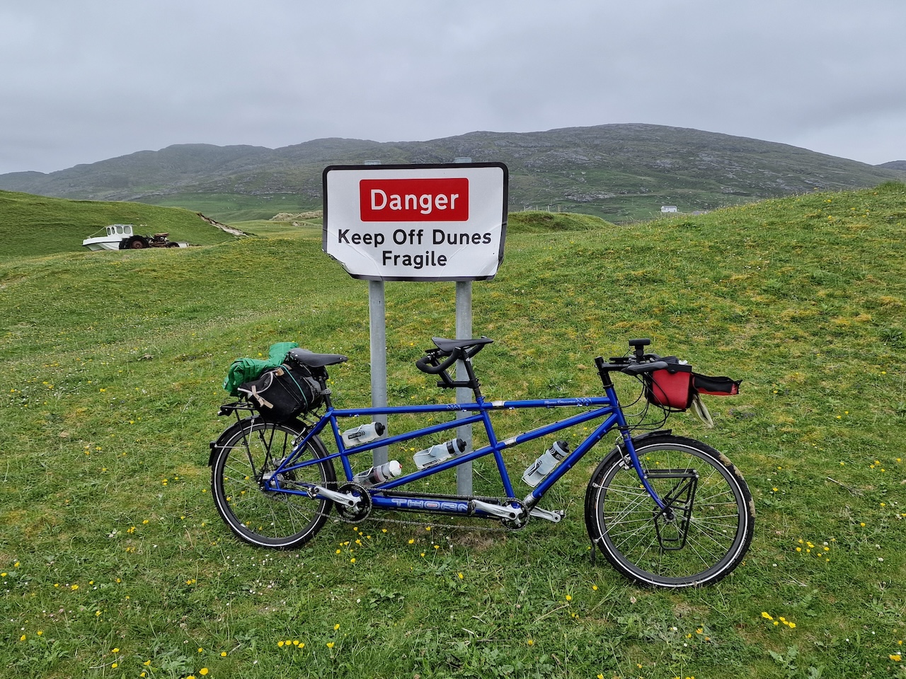
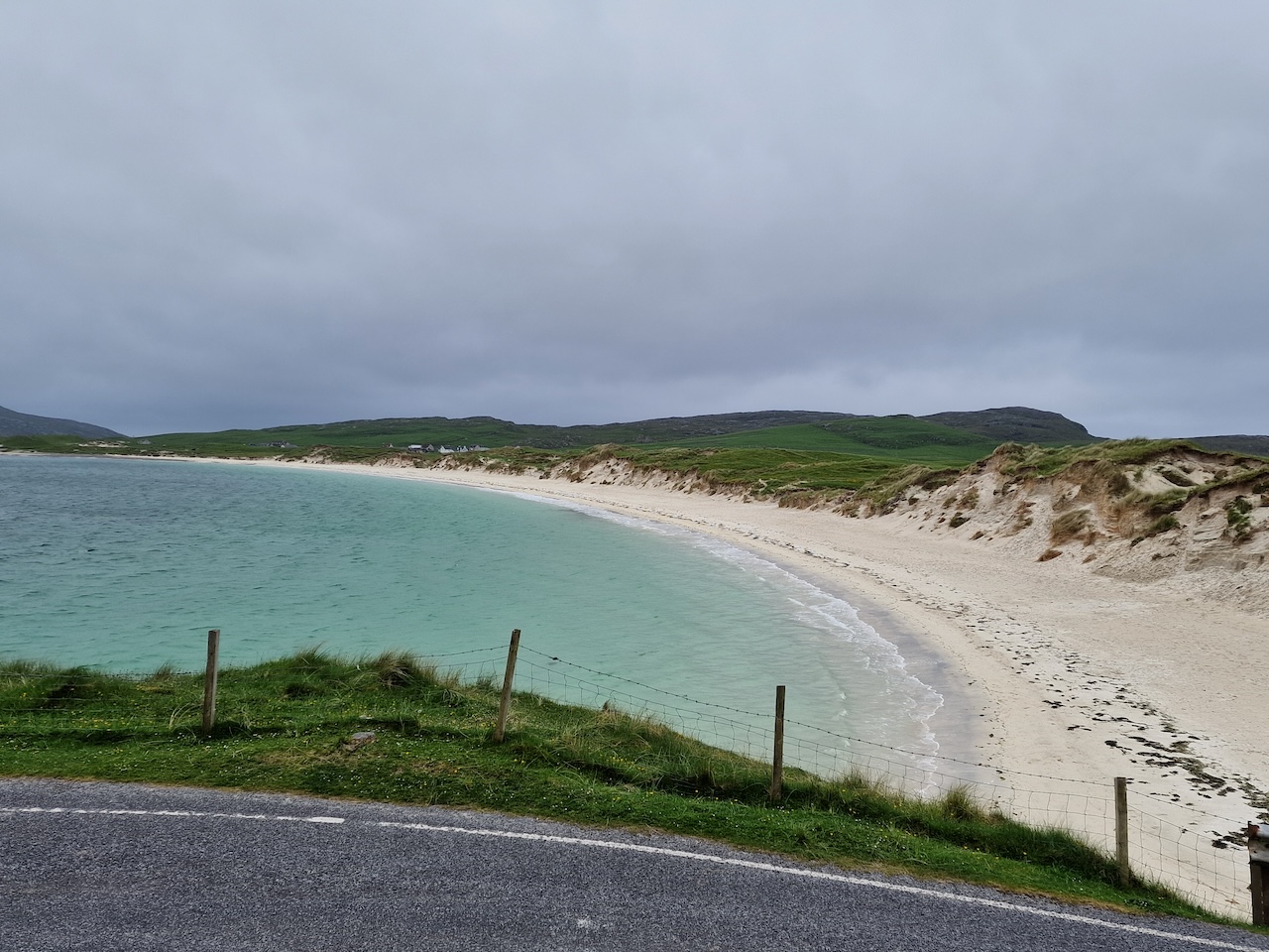
We rode past the wreckage of a World War 2 Catalina, which seems to have acquired a memorial. We didn’t stop as we’d done so on a previous visit. We saw seals, more hooded crows, and what may have been ravens. At Vatersay’s famous beaches, the dunes are more fenced off nowadays to protect them from erosion. A lot of camper vans and cyclists.
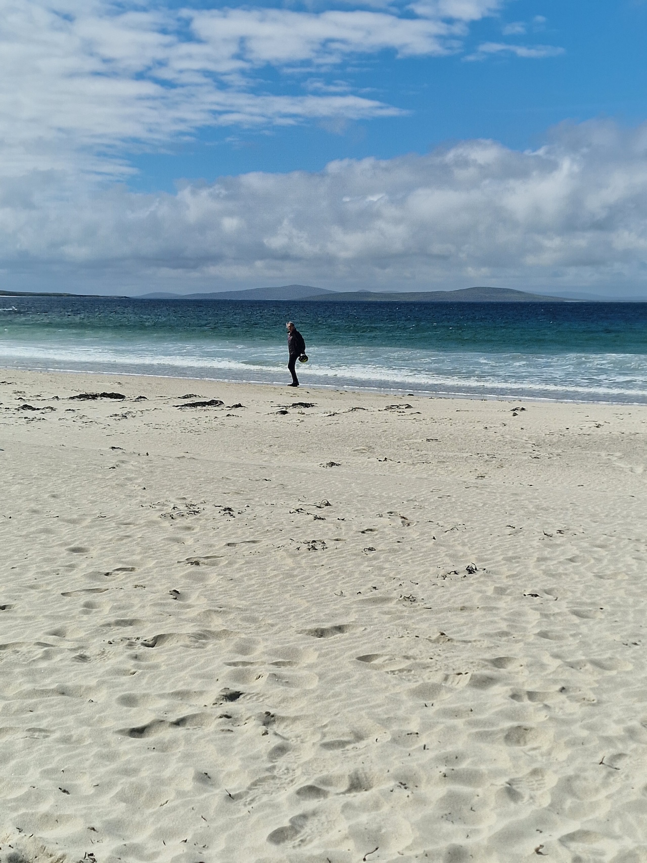
Beach at Vatersay
Looking back at Vatersay beach from the climb
We rode back to Barra and past the B&B and still no rain had started, which was good, so we rode up the west side of the island, past the Isle of Barra Beach Hotel. We’d stayed there on a couple of previous visits to Barra but I’m not sure it’s operating at the moment as it is up for sale.
Then past the Greim at Grinn seafood shack (too early for a lunch stop, but we planned to stop there on the way back), and on to the Northbay turn and then up to the airport. There was a bit of drizzly rain by this point. The tide was in, but seemed to be receding fast and the red airsocks were out. On a previous visit we’d had a welcome cup of tea and cake at the cafe in the airport, but this time the building seemed deserted. There were numerous vehicles in the car park, perhaps waiting for the plane to arrive when the tide was out. Because the planes land on the cockle strand beach, it's the only UK airport who's schedule is dependent on the tides.
We turned back into a headwind, which made the drizzle a bit fierce, and retraced our route to the Greim at Grinn seafood shack we’d passed earlier. I had scallops and black pudding in a roll, Carol had fried haddock wrap with salad. These made for an excellent lunch! Highly recommended.
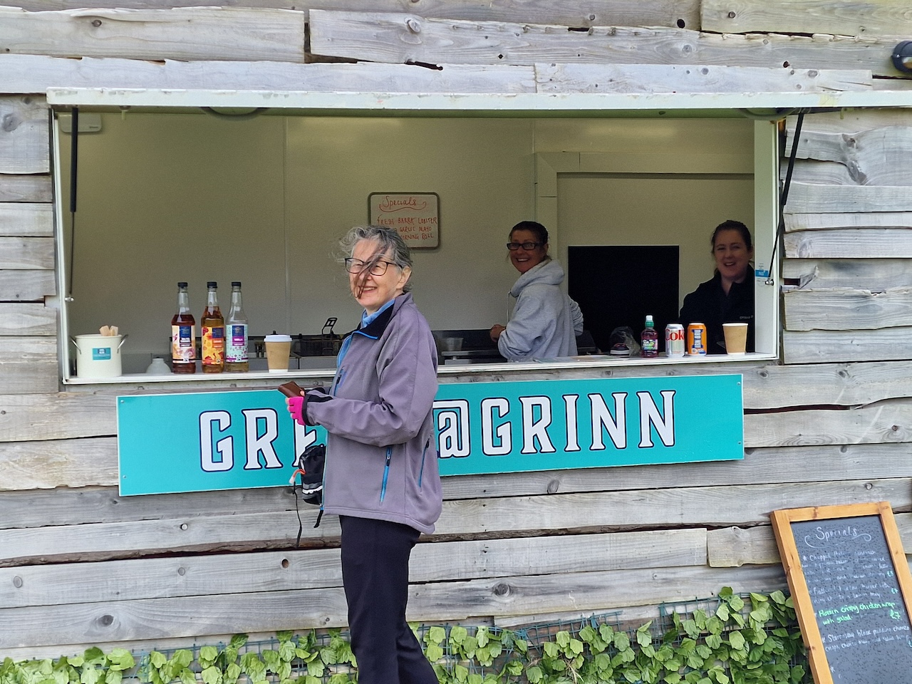
Carol at the Grein@Grinn seafood shack.
Then we headed back towards the B&B. The drizzle got a bit worse and for the last 5 or 10 minutes it was quite heavy. We got back to the B&B by about 1.30pm. We got dried off and changed, then took it easy through the afternoon, until the rain stopped, when we popped out for a walk to the Co-Op.
Nature points: Saw a couple of gannets diving, and what may have been a pair of ravens. We were stared at by seals as we crossed to Vatersay.
Just 43.58km today - here's the route on Garmin Connect
Day 3 Eriskay, South Uist, Benbecula and North Uist, Wednesday 29th May
The plan for today was to ride through Eriskay, South Uist, Benbecula and North Uist to Lochmaddy, where I had booked accommodation. We were up fairly early because we planned to ride to Ardmhor ferry terminal for the first Eriskay ferry at 0925 and we thought it prudent to allow some time for mechanical hiccups. In the event the ride was straightforward, so we arrived early, and had to hang around for a while before the ferry came in.
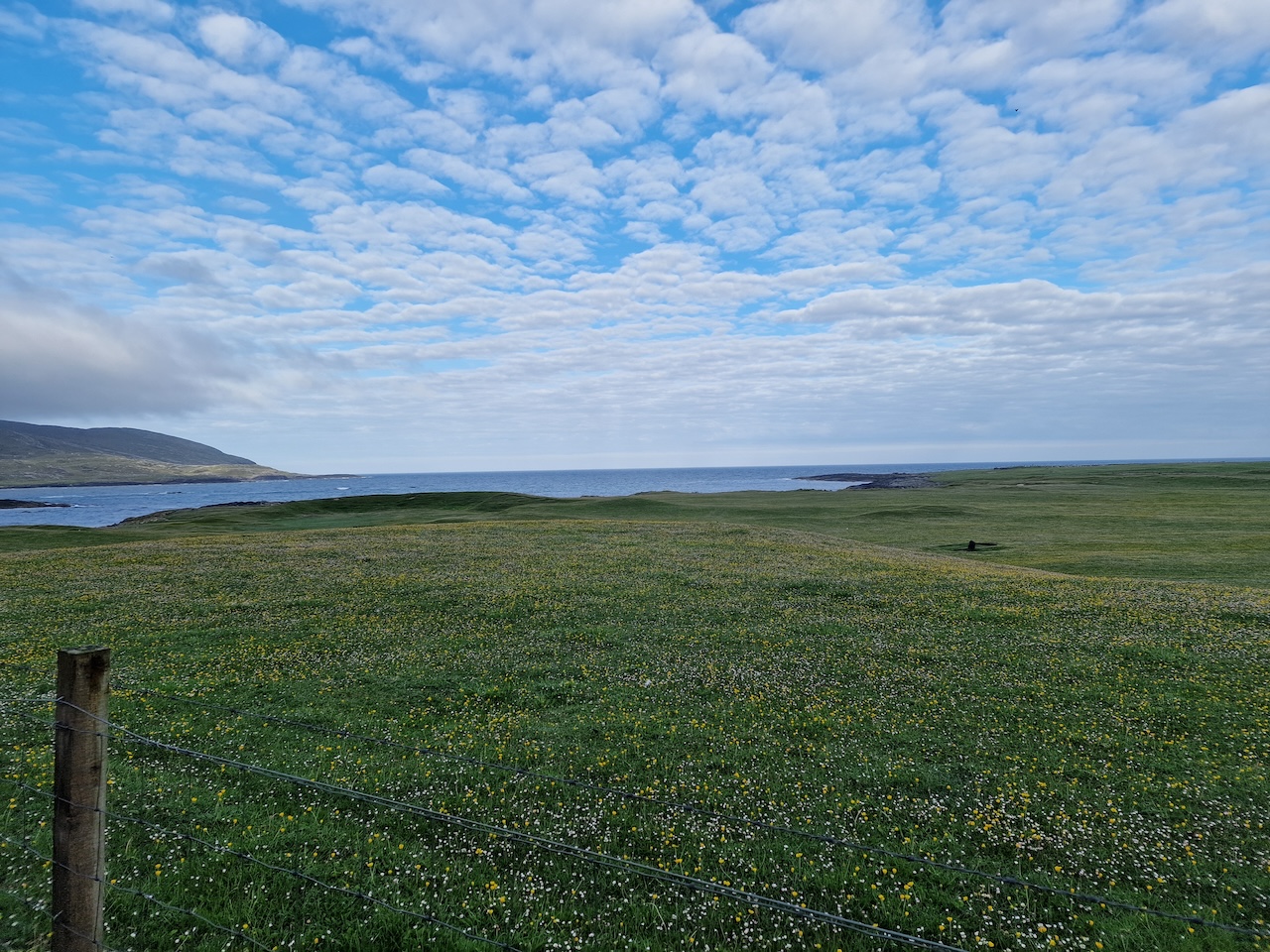 Machair on Barra
The weather seemed to be brightening, as per the forecast, though really we never saw a lot of sunshine until the evening. Unfortunately, it looked as though we would face a stiff headwind for most of the 58 miles today.
 The ferry approaches - Ardmhor, Barra
 Ferry leaving Eriskay for Barra
Once off the ferry, there’s a hefty climb up the big hill on Eriskay (we paused to take a photo, but also this was an excuse for a short breather!), then descended and crossed the causeway to South Uist. Here the headwind was really obvious. Because we had a projected long day in the saddle with a headwind, we opted to just head north on the island’s main road, a lot of which is single track.
There aren’t many places with cafes on the Uists. There is one in West Kilbride just after the causeway from Eriskay, but this was a bit too soon for a stop. So we carried on up the road and eventually stopped at the Kildonan Museum to avail ourselves of the cafe there – coffee/tea and scones provided fuel!
We also made a lunch stop near the Our Lady of the Isles statue – there was a convenient bin to lean the bike on! We heated up a pouch of curry and rice on our trusty Trangia cooker. A pair of cyclists that we recognised from Barra came by and one of them pedalled up the track to the statue while we chatted to the other one. Lunch was a sachet of chick pea curry with rice.
 Lunch stop by the bins, South Uist
Restarting the ride, we called at the Co-Op in Benbecula for snacks, and then pressed on. It was getting a bit tough by now, with a little fatigue and the ever-present headwind of around 15 to 17 mph. On the single track sections of road, we found ourselves having to stop quite frequently at times, which not only lowers the average speed but is quite fatiguing in its own right.
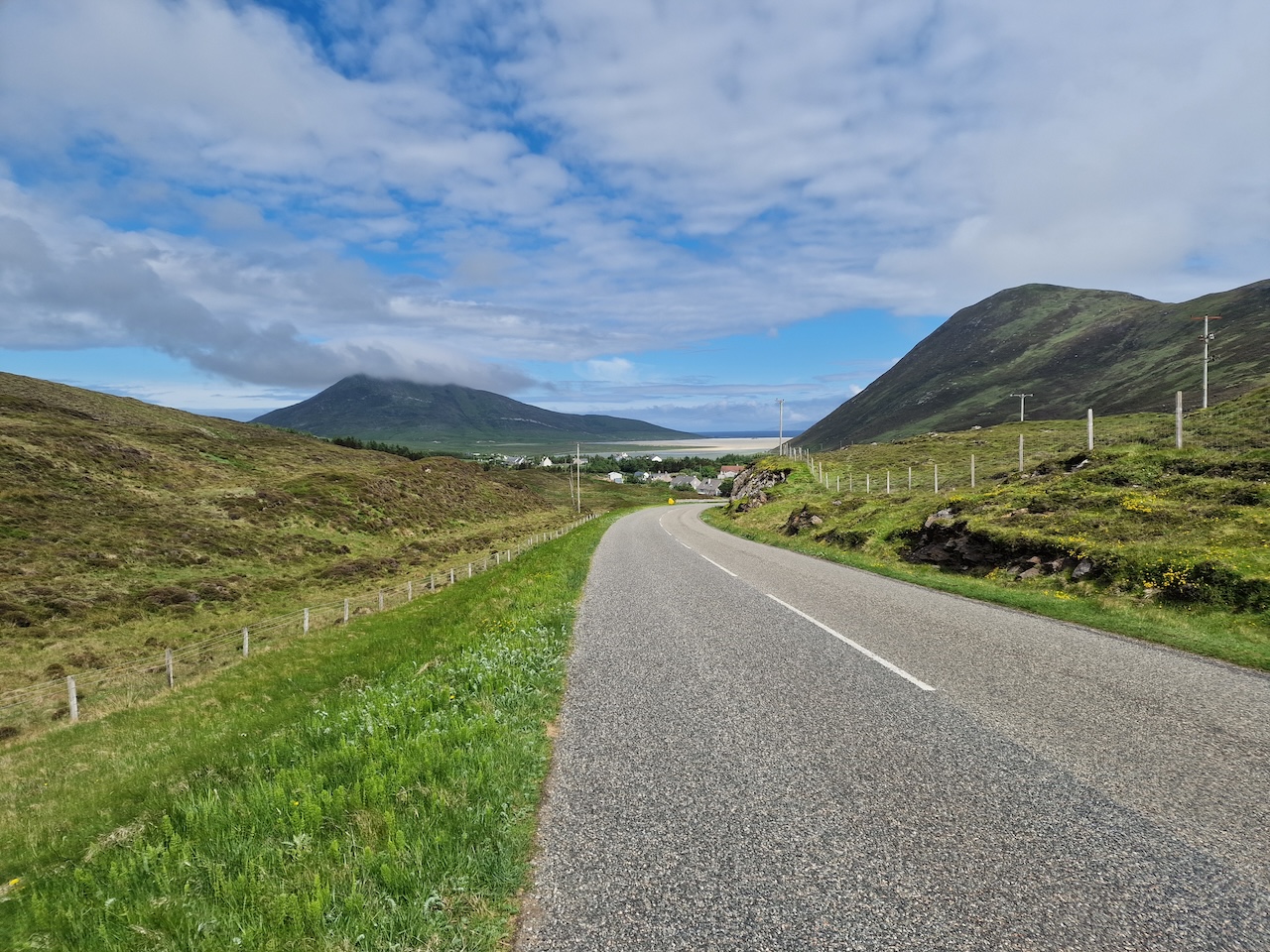
Eventually we reached Clachan and turned off for the last 7.5 miles to Locchmaddy, where the sun appeared, albeit briefly. We stopped for a drink and a snack before carrying on. From here on the road was wider and had gentler gradients and the wind was more of a side wind, so we were making faster progress.
After we got to Redburn Guest House, the sun was peeping out from the clouds and before long we had the long-promised sunshine.
We wandered over to the Hamersay House hotel for a beer and for dinner – I had (more) scallops for starter, then lemon sole for main course, while Carol had the peculiar sounding black pudding “bon bons” for starter (they were actually very good!) then haddock and chips for main course. I had a bottle of Skye Black and Orkney Corncrake.
After dinner, we went out for a walk in Lochmaddy in the evening sunshine. Not has changed since our last visit, which must have been a decade ago!
Day 4 North Uist, South Harris Thursday 30th May
Redburn House is a ‘self-service’ B&B, with no resident manager – breakfast is provided for guests to help themselves. This was convenient, and this enabled an early breakfast so we could set off by 7.30 to cycle over to Berneray for the 9.30 Leverburgh ferry.
The plan for today was for a relatively short day in mileage terms, but of course there’s a lengthy climb towards the end of the route. Nevertheless, we took our time on this ride, with several breaks. I think this was important, since the day before, we plugged away for 58 miles (with headwind), and the next day was scheduled to be over 60 miles.
Anyway, the weather was shaping up quite well, even though the wind was strengthening, and continued to be a headwind for most of the day.
On the way to the Berneray-Leverburgh ferry
When we arrived at the ferry terminal, there were only a couple of cyclists, but quite a few more turned up before the ferry arrive, including 4 e-bikes. We saw quite a few e-bikes being used for touring (judging from the panniers) on our trip, and not being an e-bike user myself I find it difficult to understand the logistics regarding battery life and range. Still, I guess it gets more people out and cycle touring.
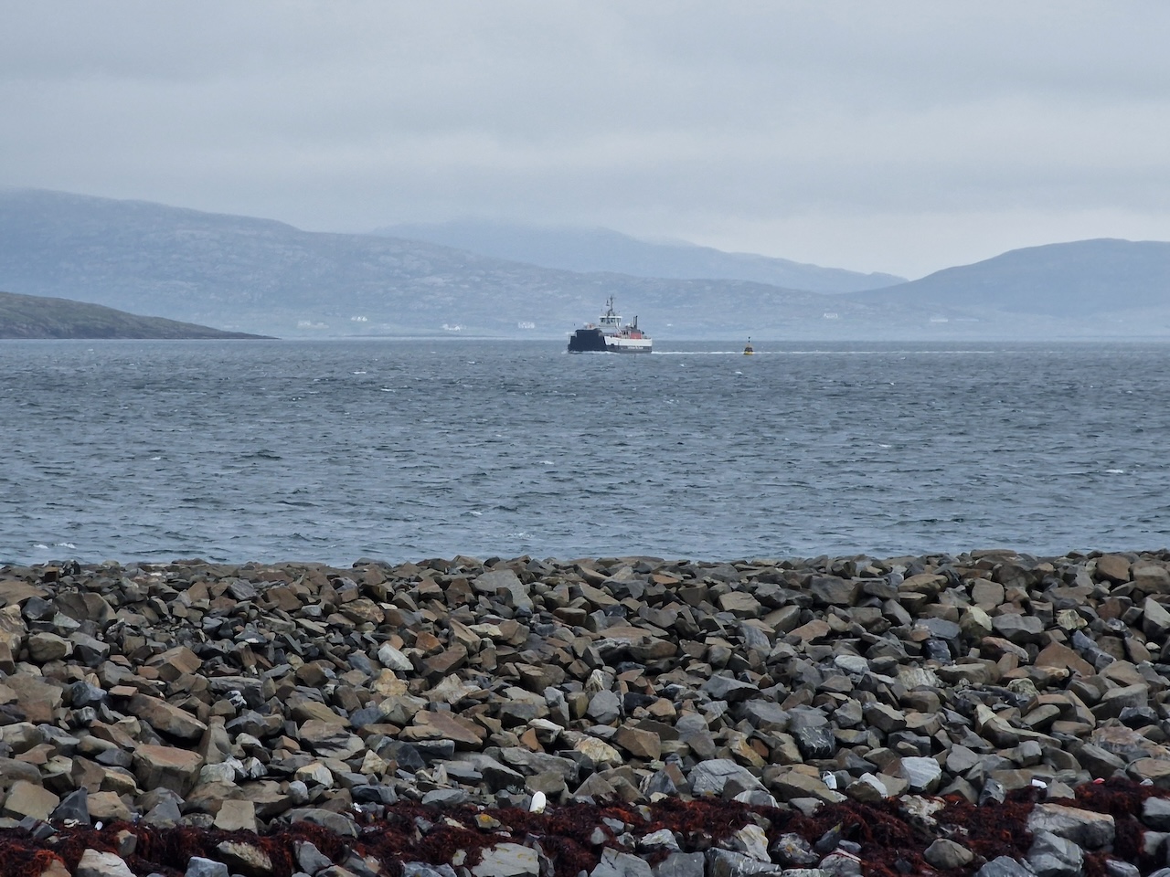
 The Berneray-Leverburgh ferry arriving
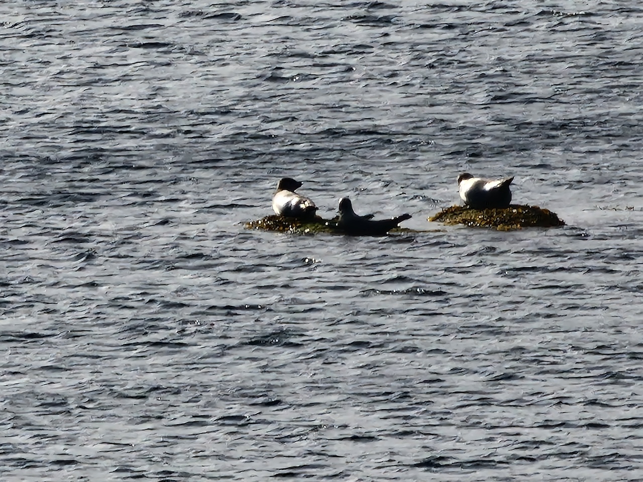
The ferry arrived in good time and left promptly for Leverburgh. The crossing was smooth and uneventful, we saw cormorants, gannets diving and of course seals. Apologies for the low resolution photo!
After disembarking from the ferry, we pedalled over to the community shop for supplies. The Gaelic name for Leverburgh is An t-Òb, and the reason for the disparity from the English name is rooted in the early 20th century when William Lever (1st Viscount Leverhulme, who made his fortune in groceries) decided after a holiday in the Hebrides to buy Lewis in 1918. he later extended his ownership to include Harris. Leverhulme had a desire to improve the local economy by starting industrial scale fishing (he even set up a national chain of fish shops). Unfortunately for Levehulme his grand plan, which modern eyes would see as rather paternalistic, failed as demobbed soldiers returned from the Great War with expectations of access to crofting land that had been promised to them. Leverhulme died in 1925, and the estates in the Hebrides were subsequently sold off quite cheaply. A good account of the events can be found in The Soap Man by Roger Hutchinson. Leverburgh remains the second biggest settlement in Harris after Tarbert.
The west and east coasts of South Harris are very different. The former has amazing golden beaches and extensive machair, while the east is more rocky with many inlets. The road round the east coast (known as the Golden Road due to the expense of building it) makes for pretty tough cycling as it continually goes up and down and is all singletrack. On one of our early cycling trips to Harris, we rode our Dawes Super Galaxy tandem, with full camping load, along this route and vowed to think twice before doing it again!
From Leverburgh, we cycled to the Temple cafe in Northton. We’d visited this cafe some years ago when we were last on Harris. On that occasion we met a couple of students on their first cycle tour to the Hebrides and sort of envied them as everything was new to them! We sat outside in the sunchine and had tea/coffee and flapjacks.
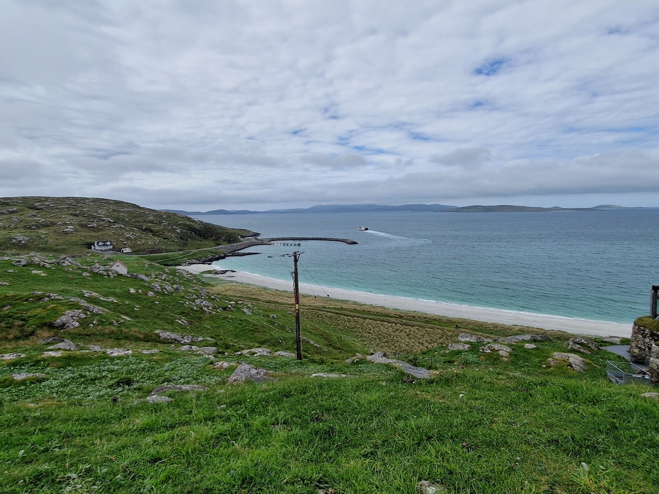
The Harris beaches come into view
At the Temple cafe - some view for our coffee break!
After that, we pedalled down to Northton Bay, which is really close by (and I can’t for the life of me understand why we didn’t do this the last time were were at the Temple cafe!). This is a really lovely little beach. We sat for a while chatting to two ladies with little dogs in tow before getting back on the bike.
Northton Bay
 Carol on the beach
Negotiating our way past the bin lorry, we made our way back to the Tarbert road, where we rode a short distance before we stopped at a favourite spot to heat up couscous for a light lunch. A lot of today's route is on singletrack road, and there seemed to be a lot of camper vans out there.
A favourite spot on Harris
At this point, we were taking our time in an attempt not to arrive too early at the B&B, so we dawdled and took our time. We watched a seabird circling round the shallows on the beach occasionally dropping to catch some morsel of food.
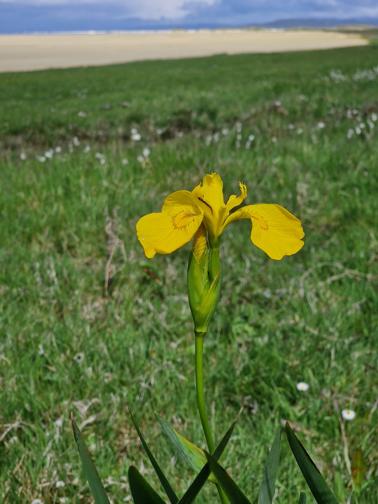 Yellow flag irises are everywhere on the Outer Hebrides
After that, we trundled on, pausing for traffic on the singletrack, and joining a roadmending convoy at one point – they were surface dressing the road. For a spell at least we were doing 20mph!
Eventually we began the long climb up through the rocky landscape of Harris. Since our early visits to Harriss, there's been some upgrade to the road here. It's alldouble track now, which makes things musch easier when you're trundling a heavily laden tandem up a long climb.
We eventually reaching the Roedean Guesthouse B&B at about 3.20pm. Unsuprisingly, there was nobody in! So we went for a brief walk before the landlady arrived.
Panorama of the rocky hills of South Harris, near our B&B
The Roedean guest house was very nice, with comfortable accommodation. Sadly, we weren't going to be able to have breakfast the next morning, as we were catching the early ferry from Tarbert to Uig, and latest checkin for the ferry was around 6.35am! I particularly appreciated the views and the bumblebee themed soft furnishings.
Rather than going in to Tarbert and, more to the point back again up a steep road, we just had some oatcakes and cheese.
This had been a really nice and relaxing day out on the bike and despite the omnipresent wind, the weather was pretty sunny and warn with only one brief outbreak of drizzle. We hit the sack wondering how the weather would be on Skye the following day.
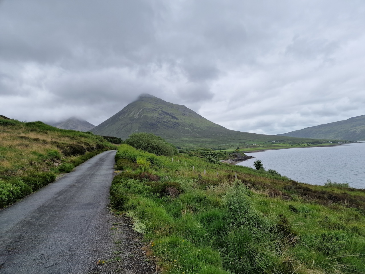
Day 5 Departing from Tarbert and Cycling on Skye
This was to be the longest day of our tour in mileage terms - around 60 miles. The plan was to catch the early ferry from Tarbert across to Uig on Skye and basically head down via Portree, Sligachan and Broadford to Armadale. I'd had real problems arranging accommodation on Skye - since the bridge was built, vistor numbers have rocketed and much of the accommodation is for rental cottages of books up well in advance. Added to this was the disappearance of the last to ferries from the website! In the end, I found a B&B in Ardvasar, a mile or so beyond Armadale.
We got up early and had a cup of tea and a snack bar. We tiptoed out of the B&B to avoid any disturbance, loaded our luggage on the tandem and set off on the 1.5 miles to the Tarbert ferry port. Vehicles were already arriving for what looked like it would be a busy ferry. Waiting to board was a bit tedious as it was fairly cold and drizzly. But at least cyclists boarded first. We nipped straight up to the restaurant, but it was still closed. We retreated to the coffee bar to find the coffee and tea facilities were not functional! Whent he announcement that the restaurant was open was made, we went and found an enormous queue had already formed. Shortly before arrived in Uig, we returned to find the queue had gone, so we had egg and black pudding (me) and egg and bacon (Carol) rolls for breakfast.
We rolled off the ferry just after 9am and set off on the long trek south. After a couple of brief stops to adjust clothing we rode up the climb out of Uig. The ride was pretty uneventful as far as Portree, where we stopped at the Co-Op for some snacks and something to drink. The catering plan was to stop at Sligachan for something to eat and make a second stop to heat food on the Trangia, maybe after heading off from Harrapool to Armadale.
 South towards Portree
We had a bit of an alarming moment when a motorist decided to pass us just as we indicated to turn right into the Sligachan Hotel car park. But no harm done! We had an early lunch of soup and coffee/tea.
Unfortunately after Sligachan, the road was unbearably busy with motor vehicles of all kinds, so we decided to turn off at Sconser to go down the Moll road. This is a little singletrack road that was in a pretty terrible state of repair the last time we rode it, about 10 years ago. As we made the turn, we saw a couple of cyclist going the other way and asked if it was passable. They answered along the lines of "yes, but..." but anything else was lost as we scooted along.
 The Moll road
 Some of the new tarmac on the Moll road
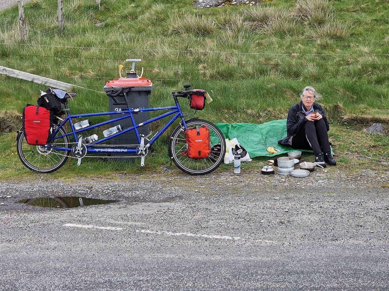
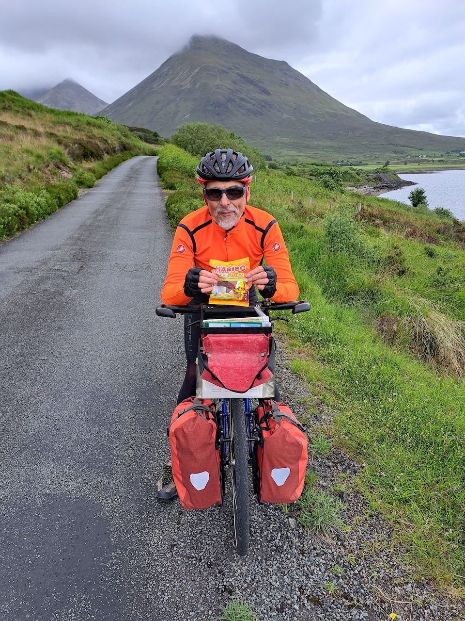 A rare photo of Robert, with the energy snack of choice
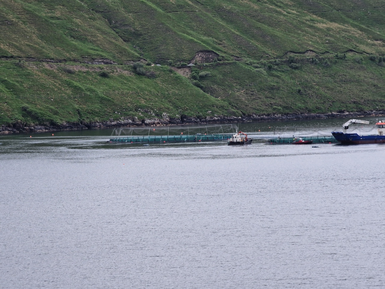
The Moll road was still in a pretty crappy state, but suddenly there was a lengthy section of apparently freshly laid asphalt. We assume that this is to allow vehicles to access the fish farm. At this point we were pretty encouraged to carry on. But then we were confronted by a sign saying that the road ahead was closed. Well, the typical cyclist's action is to carry on in the expectation that the road would be passable on bike. After negotiating a closed (but not locked) gate, we eventually came up to a mound of loose gravel, and beyond this was another mound of gravel. But between these two mounds the road had been completely carried away in a landslip.
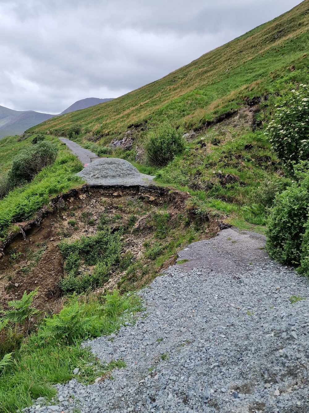 The collapsed road
We were faced with two options, backtrack a few miles and return to the horribly busy A87 for the climb over Glamaig, or try and get pas the landslip. We chose the latter. After unloading the panniers and luggage, we carried the bags across on a narrow muddy path. The we carried the tandem cross, possibly a little more alarming! Once on the other side, we reattached the baggage. All this time we had the first real midge attack which I supposed added insult.
Then it was a reasonably easy ride along dodgy road surfaces and through a few more gates before rejoining the A87. We were then back in the thick of heavy traffic until after we passed through Broadford and Harrapool and turned off towards Armadale.
 Looking back from the A87, we could see the collapsed road!
The situation with traffic levels on the A87 seems to be a combination with increased traffic since the bridge was built, plus the bank holiday week, plus the road layout which funnels all the southbound and northbound motor traffic along the A87. We saw a slightly disconsolate family on the side of the road with their car in a ditch. So maybe we got away with this quite well!
We didn't stop in Broadford as it seemed fairly busy, but then again once on the Armadale road we'd originally planned to stop and heat up some food, but it became rather heavily overcast and there were light showers. We decided to press on despite the onset of fatigue.
Arriving at Armadale, we popped into the Armadale store for some supplies, then on into Armadale and up the road to Ardvasar. This turned out to be really challenging mile of wretched patched and potholed tarmac with a serious gradient (a pedestrian warned us it was going to get steeper!). We located our B&B and unloaded alla our kit and parked our bike out the front.
After cleaning up, we walked down the road to the hotel for a pint, but not a meal as they were a bit booked up. Then down to Armadale for a look around and back to the B&B via a nice little nature trail.
Day 6 Ferry from Armadale to Mallaig, cycling Mallaig to Acharacle (1st June)
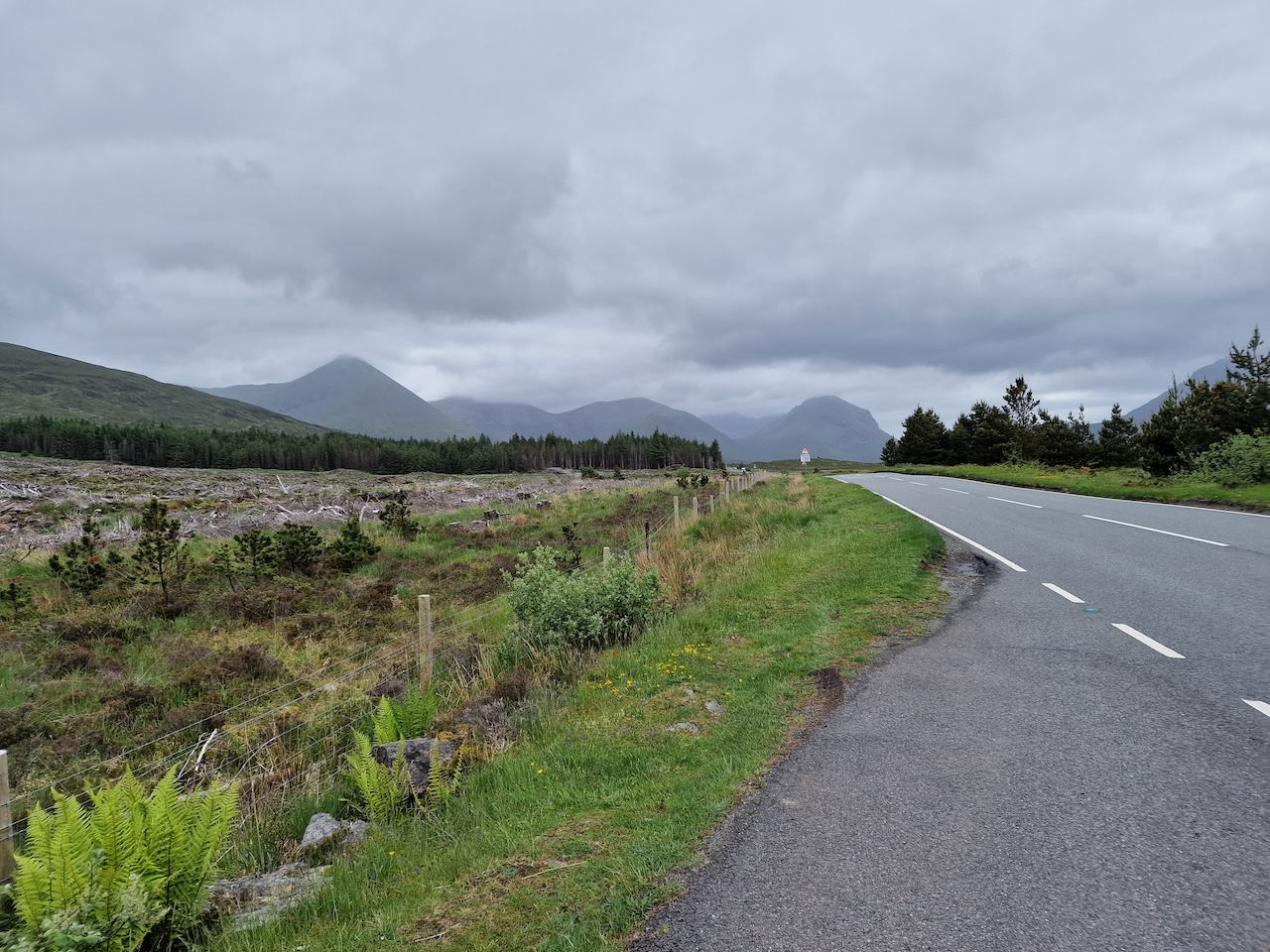
Another relatively low mileage day, but one with substantial climbs. We headed for the Loch Shiel Hotel in Acharacle, where I'd booked us in for two nights. We had the best weather of the tour so far, but we did tangle with the planned route on the bike computer. I had planned to ride on the B road through Arisaig, but as it turned out the routing (and I can't recall whether I planned this on Komoot or Garmin Connect) took us on annoying little detours with surprisingly inappropriate gradients. It seems to me that very often a specified cycle route doesn't suggest enough thought has been taken on gradient!
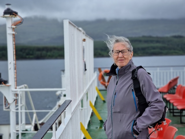
The ride down from the B&B in Ardvasar to the Armadale ferry terminal was pretty quick as it was mostly downhill and pothole dodging. We had to hang around for a bit, but we chatted with a guy on a gravel bike set up for touring. The ferry to Mallaig is pretty straightforward, and crossing is about 50 minutes. The water was like a mill pond. The ferry had to wait for a bit before docking, to let the Mallaig to Lochboisdale ferry depart.
We cycled out of Mallaig on the main road before leaving it to what I thought would be a scenic route. Instead it turned out to be difficult and very twisty. Before returning to the main road, we had a nic chat with a couple of women heading off with various accoutrements for sea kayaking. They'd been on holiday for a couple of weeks.
Back on the main road we rode up and down various long inclines - none spectacularly difficult, but draining nonetheless. the traffic wasn't very heavy, which was a relief after our experiences on Skye.
I stopped to take in the views across to Skye - here's a panoramic video followed by a couple of still photos. At some point during a fairly rapid descent, our backup bike computer popped off its mount, bounced hard off the tarmac and vanished from sight. I jammed the anchors on and Carol walked back up the hill looking for it. I eventually found it lying face down in the water filled ditch with a corner of the screen broken away.
As an aside, my main bike computer is a Garmin Edge 840, which is operated via nice combination of touch screen and buttons. The backup is an Edge 520 Plus mounted on the stoker bars, and I'm told that it probably came off because it gets nudged by me when I get on the bike!
 Everything looks great in the sunshine!
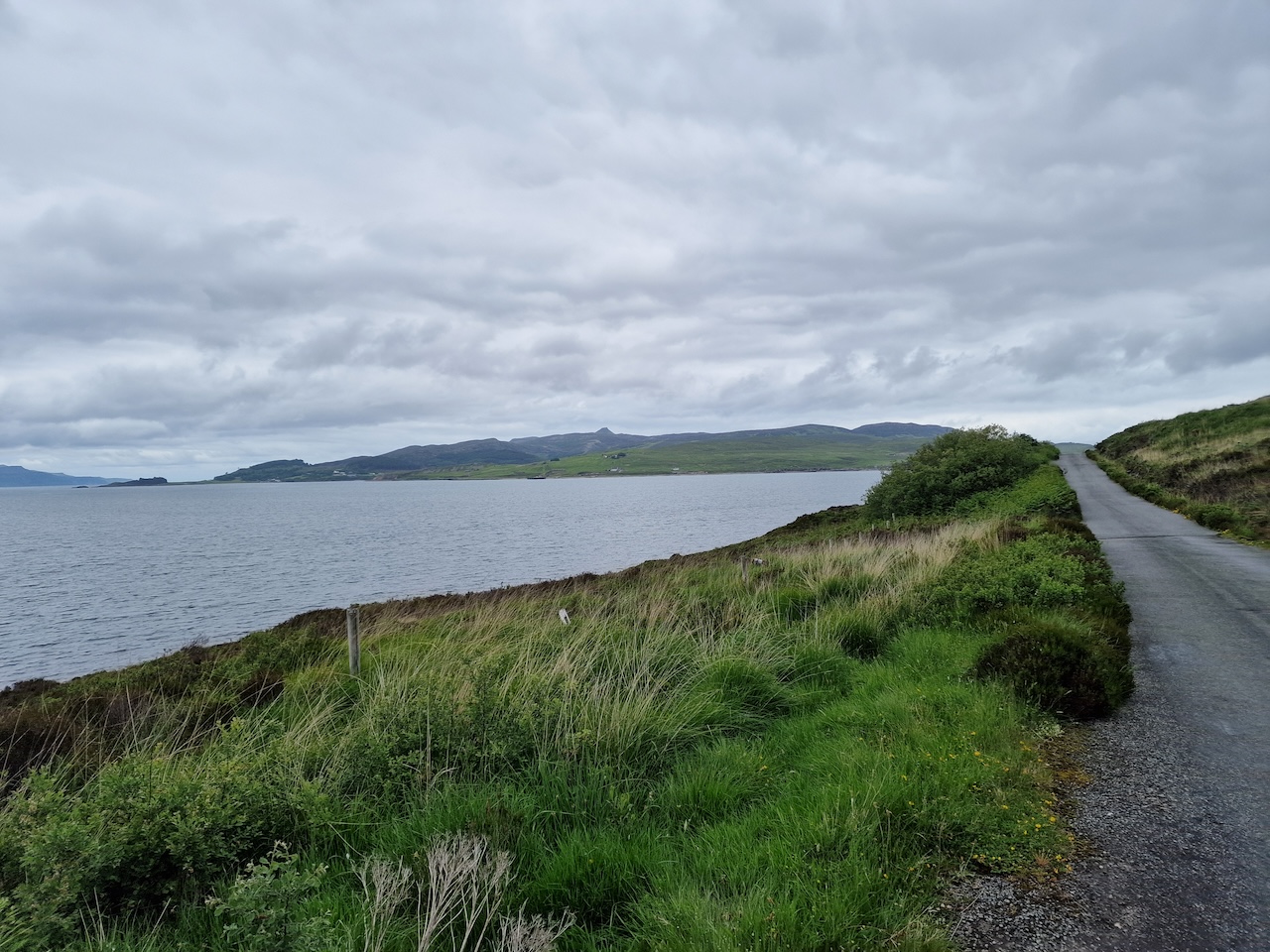
Soon we reached the Lochailort junction, where we turned to ride alongside Loch Ailort itself. We rode past Inverailort House, a former shooting lodge that was used for SOE training in the Second World War. It seems to be uninhabited and each time we pass is in poorer conditions, which is a little sad.
By this time, we were looking for a spot to stop for lunch. This road is really pretty lovely, not too demanding, though as with all lochside roads, it does tend to go up and down a bit! On previous visits, we'd seen evidence of much house construction, but there was less of this obvious to us. We stopped to investigate potential picnic spots and eventually settled on one which wasn't knee deep in bracken. We hauled our saddlebag off the bike and set up the Trangia to heat up some vegetarian chili and rice.
It turned out to be a delightful spot, and in fact was the only occasion I tried out the HoverAir X1 camera to take the following video.
Once lunch was finished, we packed up and continued riding along Loch Ailort to Glenuig, where we stopped for a welcome ice cream at the little village shop before tackling the stiff climb and descent to Loch Moidart. This was the first of two serious climbs, but I think we rode up at a sensible pace, though not without perspiration! Over the top and we zoomed down the other side, alongside Loch Moidart and inland a little way to Kinlochmoidart. Here it's delightful, with singletrack roads and pretty cottages. Near here is the place we set up our tents on our first ever cycle camping trip with a couple of work colleagues, back in the mid-1990s. It was a weekend trip, and this was the second night, under trees by River Moidart, near the Kinlochmoidart estate. As I recall a wedding had been taking place and the happy couple came strolling by.
One further climb awaited us - and this was if anything a bit harder that that from Glenuig. But once again, we covered this in good style before whizzing down the other side into Acharacle. Acharacle never ceases to amaze me with it's beauty. There's a wide area of lush meadows with occasional houses, guest hoses and farms, and you cycle over River Shiel, alongside Loch Shiel and into the village itself.
Our accommodation for the night (and the following night) was the Loch Shiel Hotel. We'd stayed here a few years back, when it had just changed ownership, having been taken over by a new team of young people. At that time they were just getting it all set up, though our stay was nice and I was keen to revisit. On this visit, th hotel seemed to be up and running well! After getting cleaned up, we arranged to have dinner, then sat outside drinking Spean Bridge IPA in the evening sunshine. After a brief wal down to a jetty at Loch Shiel, we had dinner. I had cullen skink (a particularly nice rendition of this classic soup, with chunks of new potato and smoked haddock very evident, followed by a main course of even more scallops. Carol had an excellent prawn cocktail with massive prawns follwed by the excellent scallops.
 Beer!
Beer!
It was the first fully sunny day of the trip, absolutely delightful. Unfortunately, the forecast for the following day did not look at all good.
Day 7 Sunday Acharacle (2nd June)
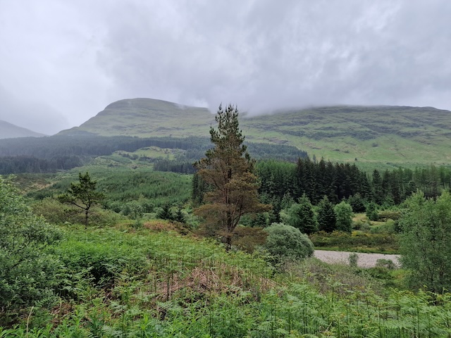
It was a bit hard to believe after yesterday’s excellent weather, but the weather forecast for rain all day turned out to be true. We did get out for about 18 miles in the drizzle, cycling along Ardnamurchan as far as Glenborrodale through lovely mixed woodland. Saw a red squirrel. A very wet red squirrel!
 The morning view from our room - somewhat drizzly!
 Woodland in Ardnamurchan
The drizzle was proper Scottish drizzle and we got pretty wet except where protected by waterproof jackets. My fluorescent Castelli jacket seemed pretty much up to the task, but I had water dripping out of my helmet, which was a bit smelly! On the way back, we stopped at the Salen Jetty shop/cafe for coffee and snacks.
 What a difference from yesterday!
When we got back to the hotel, we got changed and loafed about watching TV. Dinner was prawn cocktail and fish and chips for me, but Carol didn't have a starter and went for the main course sized cullen skink. During dinner we chatted with a couple at the next table who were coming to the end of a sea kayaking holiday.
After dinner, the rain stopped, so we went for a walk down to the loch. The weather forecast for the following day was looking rather lovely, and just right for the haul over the hills from Loch Sunart to Lochaline.