
Normandy 2023
It had been 5 years since we last packed for a Normandy holiday, including both the tandem and a solo bike. Since then we’d changed to a more modern Ford Focus, and I at least had a few concerns that all our stuff wouldn’t have fit inside.
I needn’t have worried.
We took the usual strategy of making a layer of cases and other bags (like the handlebar bag and saddlebag, a bag of shoes and helmets) and boxes. On top of that, we laid a plastic sheet in case the tandem's Rohloff hub let any oil out. Next in was the rear section of the tandem, with rear handlebars and pedals removed. An old counterpane followed (to minimise clinking and clonking), and in turn, the front tandem section, with handlebars turned through 90 degrees. Another old sheet followed, before the Cervelo P3 (minus wheels and pedals) was placed on top. The tri-spoke wheels were added in wheelbags. To be fair, fitting the Cervelo in was a bit of a fiddle, but it fit in with the rear of the frame going in first.
Finally, a number of other bags and things were added in various nooks and crannies. We made sure the overnight bag for the ferry was easily extracted.
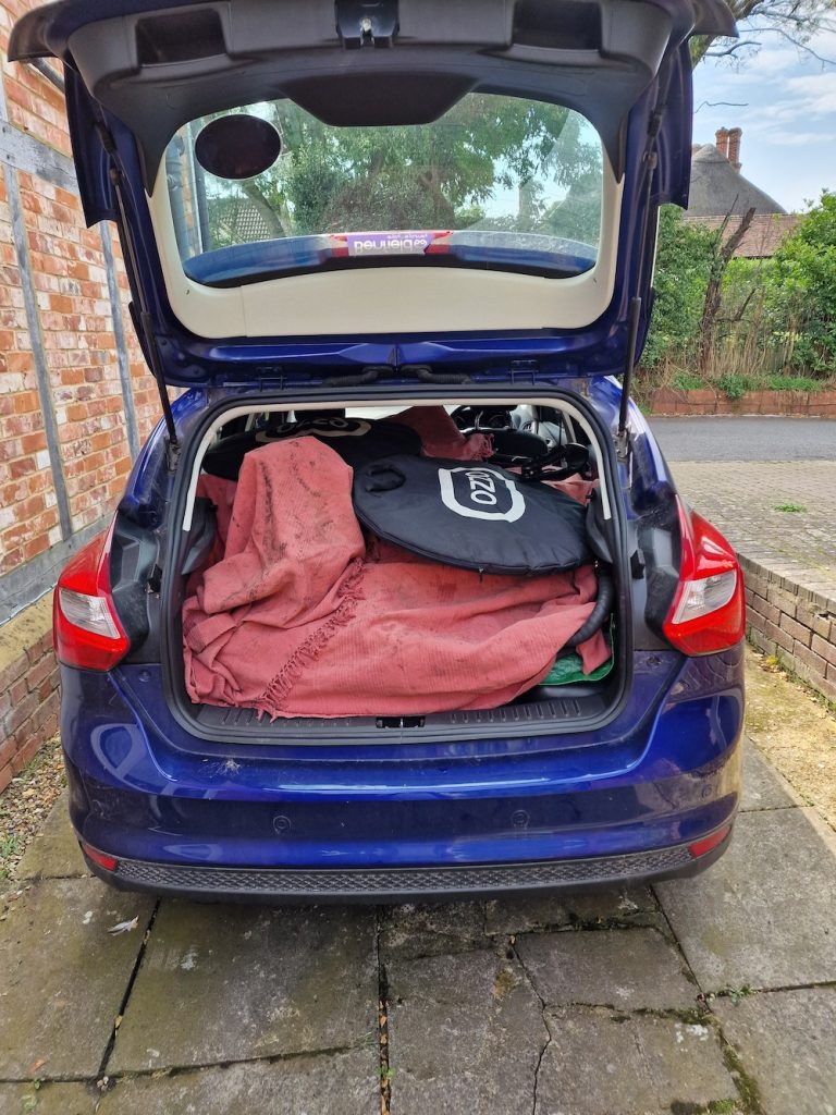
We were packed much more easily than expected, and consequently ready to depart for Portsmouth very early.
Of course, we were a bit concerned about delays en route, particularly on the M25, so we set off very early around 5.30pm. We hit standing traffic on the M1 almost immediately, but fairly soon we were moving pretty well. This state of affairs lasted util the M25, when we had several lengthy delays, especially at the junction with the A3, where large-scale construction work is ongoing until 2025.
Pausing briefly at Liphook Services, we ended up reaching Portsmouth well in advance of the latest check-in. As it turned out, so had most of the other passengers, and the ferry terminal was pretty busy. Rain had started to fall and it was hot and humid so the inevitable lengthy wait for boarding was a bit tedious.
In any event, we departed on schedule at 22:45, though we did have to wait for the cabin to be ready. I'd booked a cabin with a window, but in fact all we could see was a lifeboat!
And so to bed...
Saturday 19th August
As usual I had a pretty disturbed night, as did Carol. We breakfasted in our cabin on croissants and coffee brought with us, and eventually got to the car a bit before 7am.
Unfortunately we were quite late disembarking due to our position on the ferry, and we found ourselves pretty much last in the queue for passport control. It took the best part of an hour to exit the harbour at Ouistreham, much longer than I remember it pre-Brexit.
We had no problems navigating to Cerisy-La-Salle, which we reached by about 09:30. We had arranged to get to the Gite at 1pm (earlier than the usual 4pm), so we went to buy something for a picnic lunch and drove to the seaside for a picnic. We first went to Hauteville-plage, but couldn’t see anywhere we could leave the car unattended - it had all our stuff in it, after all.
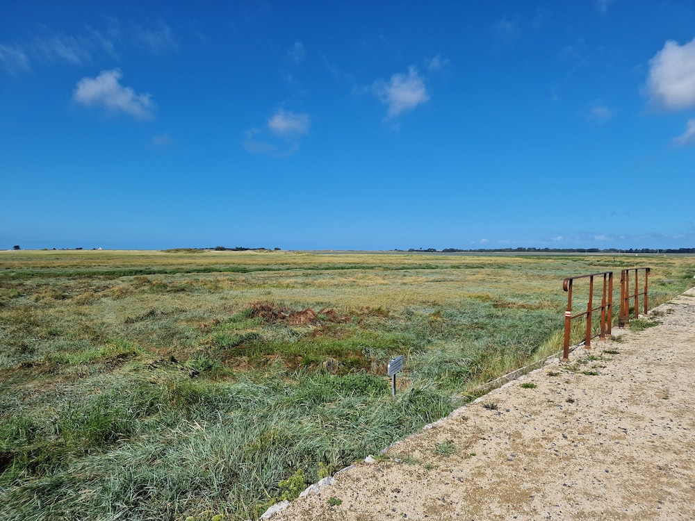
We moseyed along to Regneville and parked by the road looking over sea marshes towards the beach. After a sandwich, we wandered along the road and back. There’s a very ruined castle - so ruined it is surprising that the remains are still standing!
Then off to the gite to unpack - we arrived there spot on at 1pm and introduced ourselves to the managers, Valérie and Alban. I think Valérie remembered us from a few years back when we caused a bit of astonishment by unloading not just a solo bike but a tandem from the back of our car (as we did again this time). And they didn’t ask for the deposit, so we must have looked quite trustworthy! After a quick coffee, we went to the big E. Leclerc supermarket on the outskirts of Coutances for supplies for the next few days.
I made sure the tandem was properly assembled, checking the three frame coupling, that the pedals and handlebars were all tightened. I made sure the rear rim brake was connected and the rear hydraulic brake was mounted securely. And finally checked the gears were working. Then the same sort of check for the P3.
All in all, a pretty tiring day. Very sunny and hot, which looked to continue for most of the next week.
Sunday 20th August
Having slept for a solid 8h I woke feeling pretty refeshed. After first breakfast, I nipped out on the P3 round a regular training circuit devised by Gerry some years ago for Duo Normand preparation. This was lovely, even though I was trying to keep the effort up!
I decided we ought to do a relatively short tandem ride for our first full day, so I retrieved an old route that had been compiled using Garmin Connect, and headed over to Hauteville-sur-mer plage. This was pretty uneventful, except for the Garmin trying to send us down short sections of cyclepath. These could be decoded pretty easily and it wasn’t too much of a problem as the Edge 840 recalculates these things pretty adroitly.
It was absolutely fabulous to be cycling in the Normandy lanes again after a break of several years. I never get bored with the quiet roads that are mostly very high quality, and the scenery is lovely.
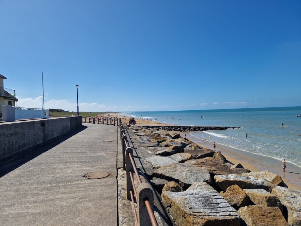
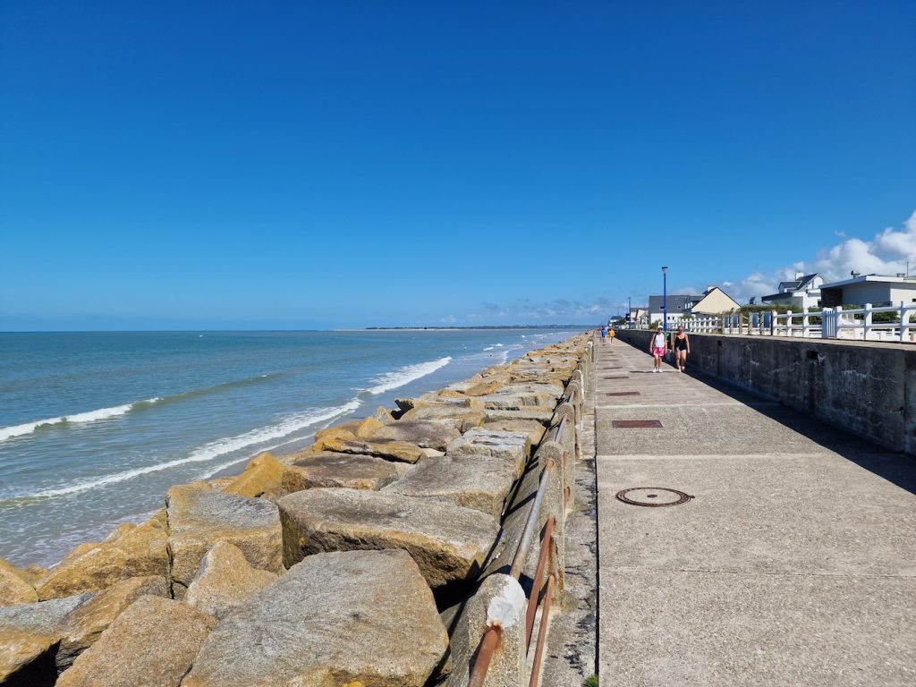
We sat on the sea front having our ham sandwiches and fending off the wasps. While Carol had a bit of a paddle in the sea, I loaded up the route for the return leg, but we found it a bit problematic, as the street layout (compounded by a market occupying several streets) made it difficult to reach the start point of the return route.
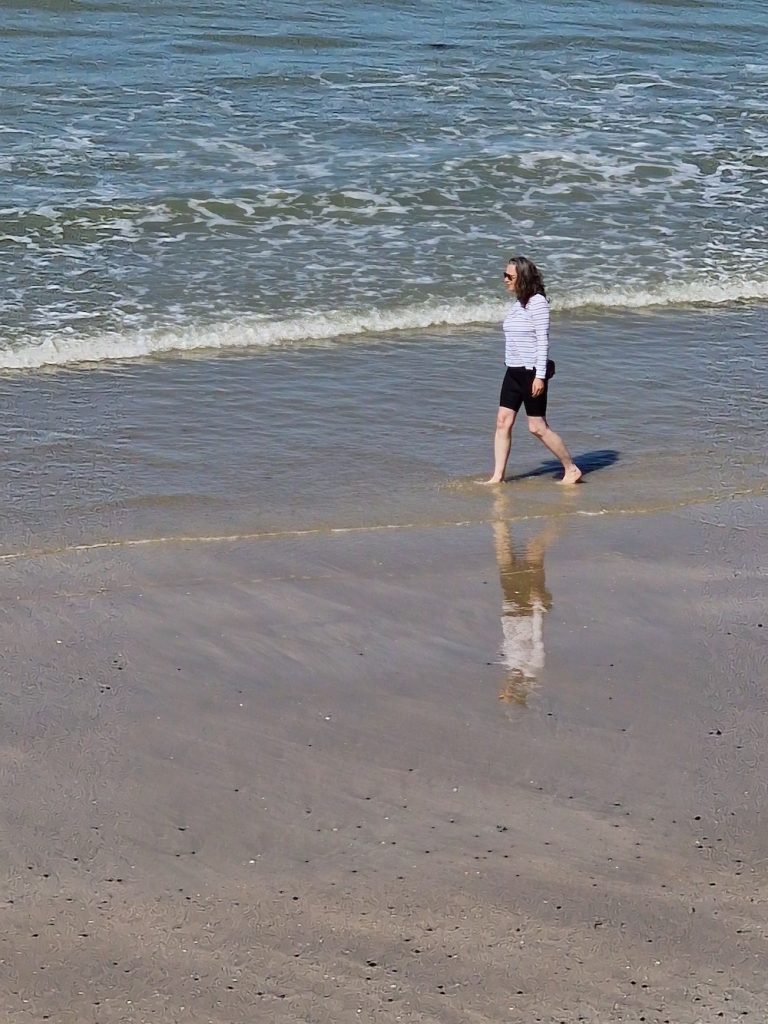
We then tried to use the outbound route and to navigate to the start. That proved an interesting experience as the Garmin seemed to keep routing us in odd directions. We eventually decided to navigate manually using our memories of the outbound route. So it ended up OK. But we decided to try out Komoot for the remaining rides. I’d set up an account a couple of months earlier, and I’d been playing around with the website, the Android app and the Komoot ConnectIQ app (which runs on the Garmon 840).
Back at the gite, we sat outside drinking the cider provided by our hosts. Then for dinner, we had grilled beef and onion saucisse in baguette and salad. And Leffe.
Sunny and hot all day
Monday 21st August
The plan for today was to ride over to Pirou-Plage for moules and frites. But first (and after first breakfast) I nipped round the training circuit and then called in at the Proxi convenience store for some bread (and mustard for the ham sandwiches).
Somewhat presciently as it turned out, I had decided to make ham and cheese sandwiches in case of difficulty in finding a suitable restaurants. I hadn't really expected to fail to reach our destination!
Today, I was using a route generated via Komoot, but uploaded to Garmin Connect and from there to the Garmin 840. It was an out and home circuit.
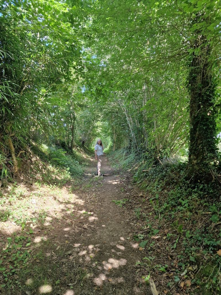
I’d specified a bit of flexibility in road/track choice, so I could ride a section of voie vert, which are rather attractive shared use pedestrian/cycling/horse rider paths (see picture below). The unfortunate side-effect was that Komoot seemed want to direct me down some clearly inappropriate routes - one was so overgrown it was invisible, others were worse than landrover tracks.
It was another glorious summer day when we set off at mid-morning, full of optimism that our switch to Komoot would make things much easier. Unfortunately, after only a few km, I apparently missed a left turn. Now, I hadn’t seen a left turn (and nor had my eagle-eyed stoker), and on our return leg, I could see a gated track at that point - clearly impassable. At least the Garmin is pretty snappy about recalculating. We decided to follow the instructions from there on. Normandy is chock full of little lanes for access to fields. These are lovely for walking (and possibly for mountain biking), but not really what we wanted for the trip.
Unfortunately a bit later on we were directed down what can reasonably be described as a Landrover track. Essesntially a farm track with two wheel ruts (very lumpy and stony) with a high grassy ridge between them. This caused significant stoker unhappiness, but we got through OK except for a boggy bit that we walked past. Finally we emerged on a tarmacked surface. Onwards to the main road, but only briefly as we headed north.
At this point we reached the main reason for the difficult off-road tracks - the Voie Vert. These are rather nice gravelly tracks, in this case with high hedges that made it look like a tunnel at times. We were enjoying this section of the route.
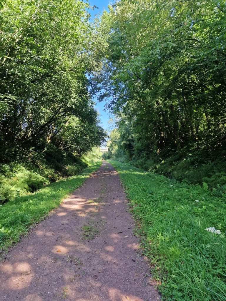
These cycle routes are delightful. This particular one had very gentle gradients and was mostly flanked by trees which afforded good shade from the strong sun. The lane periodically crosses tarmacked roads, and side lanes are quite frequent. We were pretty enthusiastic at this point.
That is, until we were directed to an unreasonably boggy track. We declined to to follow it and relied upon the Garmin to recalculate appropriately. It was one of those field access lanes.
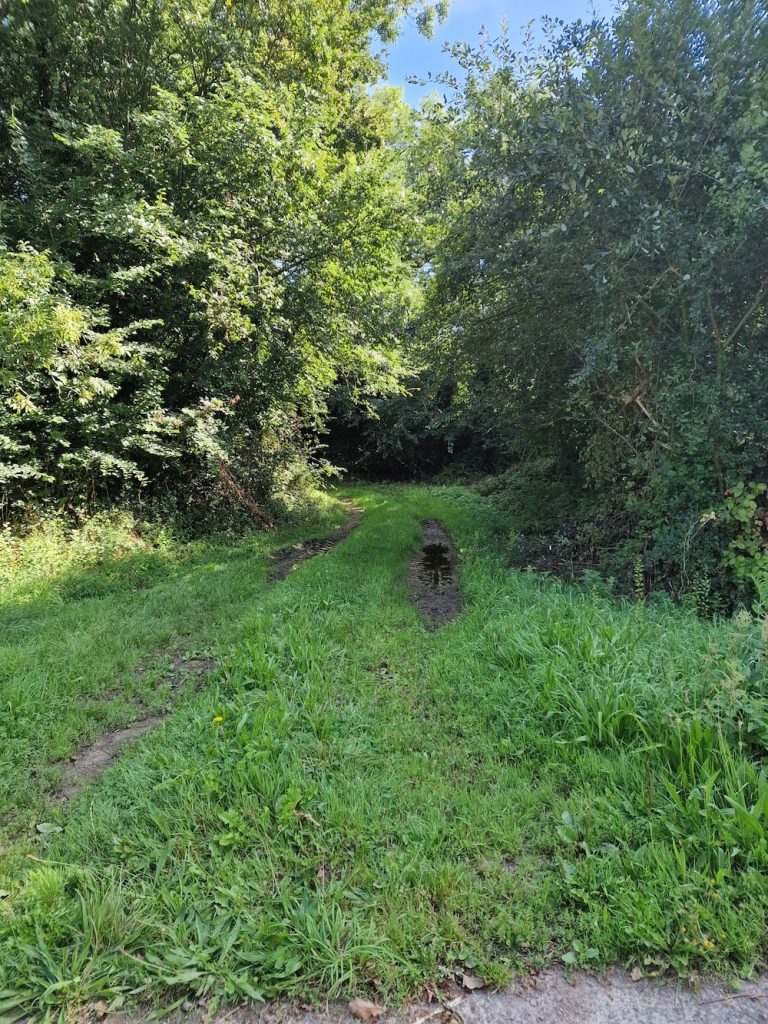
We eventually deduced that this little lane was quite short, and descended smartly to loop under the voie vert and join the road to St Saveur Le Lendelin, which was on our route to Pirou-plage.
From this point, everything fell apart, with weird direction changes ultimately having us head back south from Monthuchon. We surmised that we might have been ‘renavigated’ back to the return leg of the route. A quick perusal of an actual paper map and we refocussed the ride, deciding to aim for Agon-Coutainville. And so we set off for part two of the tandem ride!
This turned out rather pleasurable - because we were hading for the coast, it was largely gentle descents, through lovely farmland - all green and lush vegetation. We reached the seaside a bit late to have a sit down lunch, and decided to sit looking at the beach while eating our sandwiches.
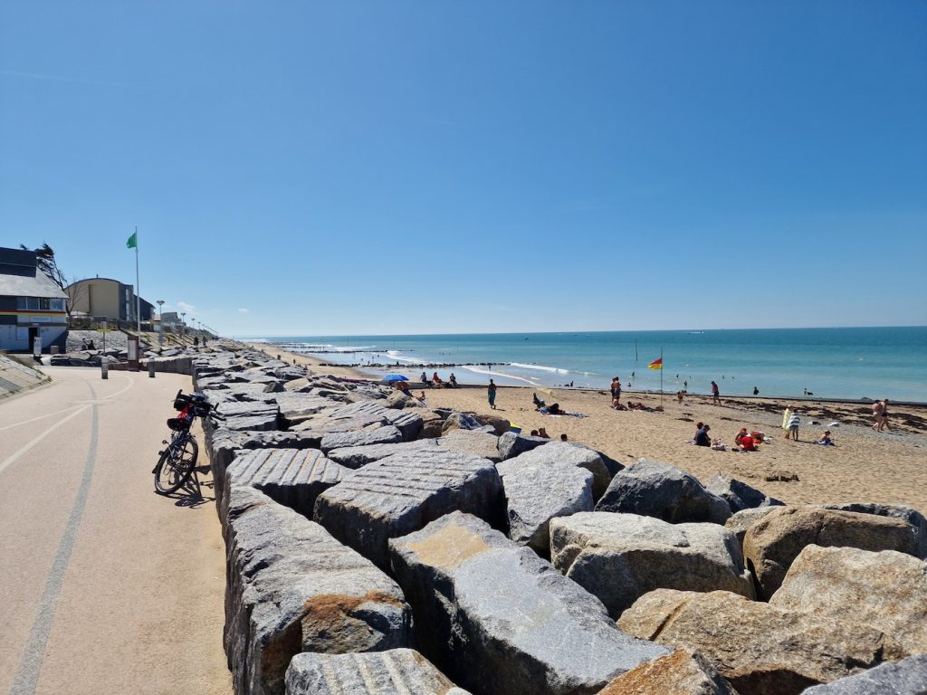
It was a shame that we'd arrived to late for a sit-down lunch, as there's a small restaurant near the beach that we've enjoyed eating at before. Still, the ham sandwiches were pretty good!
We discussed the route home, and used the Komoot app on my phone to plot a road-based route and upload it directly to the Garmin via bluetooth. It estimated 15.9 miles. And so we entrusted our cycling fate to the Garmin once again. And this was a good experience with no dirt track diversions. We’ll have another go using Komoot for tomorrow’s ride.
Back home, we cleaned up a bit and walked up to the Cerisy-la-Salle Proxi convenience store for a few supplies, then back again.
We were both pretty tired, so an easy evening watching DVDs followed a light dinner of omelette and salad.
Sunny and hot all day.
Tuesday 22nd August
I felt a bit tired this morning and decided not to do a training ride. In fact we decided to have a generally easy day today!
Our plan was to ride over to Les Roches de Ham, have lunch and then once we’d returned to the gite, we’d make a trip to the big supermarket for more supplies. Les Roches de Ham is a popular viewpoint looking over the Vire valley.
Among other things, this was a test for the Komoot route planning after yesterday’s fiasco. Today I plotted the routes on my phone and directly uploaded them to the Garmin (as we did for yesterday’s return route from Agon-Coutainville). For these routes, everything went well.
A pretty uneventful day. As usual, some tough little climbs alternating with some lovely (but sadly short) descents. We were cycling through lush green farmlands with sturdy looking stone built farmhouses, the occasional grand building that might possible be labelled a chateau, and occasionally observed by a herd of bored looking cows.
We arrived at Les Roches de Ham before noon and were delighted to see the creperie still operational - there’d been some uncertainty on that score as it wasn’t mentioned on Google Maps. We were less happy to find out that all the tables were reserved!
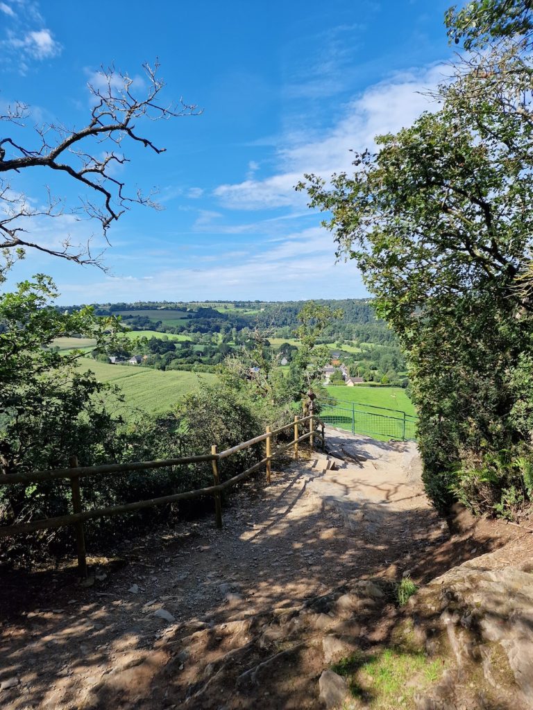
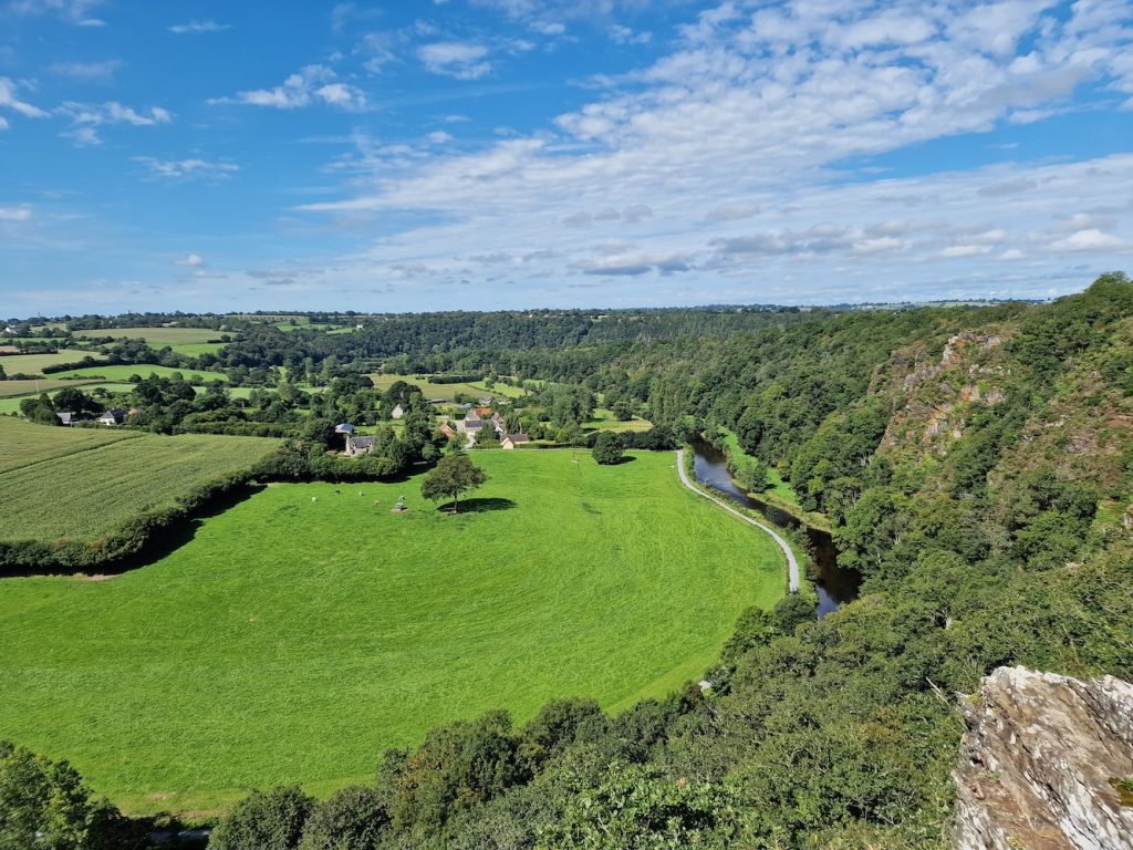
The fallback was to eat the sandwiches I’d prepared in case the creperie was closed. Which was just as well, considering! Fortunately there's a picnic table near the one of the viewpoints.
The return leg was as uneventful as the outward leg, back to the gite for beers and dinner.
Wednesday 23rd August
Today was the day we were planning another attempt to ride over to the coast at Pirou-plage. And hopefully have moules et frites.
But first, I popped out for another training ride round the usual training circuit. This went pretty well, with the fastest ride of the timed section so far - 45:15.
Back at the house I transferred the outbound route (and its reverse) from my phone to the Garmin. Once again, I made sandwiches in case we didn’t have the planned lunch. It’s about 22.8 miles from the gite to Pirou-plage on the route I set up. I had carefully checked that no tracks, trails, alleys, fields, Landrover tracks, rubble-filled ditches or any other non-road sections were in the route!
As it happens, the hardest sections of this route are in the first half, with quite a few slow drags and steep climbs - the first of which is in the first couple of miles, when we took a sharp right to begin a long climb up to Montpinchon. We encountered a glitch in the route when we reached Belval-gare, as Komoot’s (or maybe Garmin’s) map doesn’t take into account a recent change to the road layout.
But that was pretty easy to figure out and we went on our merry way. We’d set out under cloudy skies and with pleasant temperatures, but as we approached the coast, the skies cleared and temperatures rose!
The last few miles to the beach itself are in a dead straight line with a gentle descent for the most part, which make the run-in rather fun. Of course, as you approach the beach you have to keep an eye out for holiday makers in swimsuits and flipflops wandering about in the road. But in any event we wound our way past pedestrians and parked the tandem outside a restaurant.
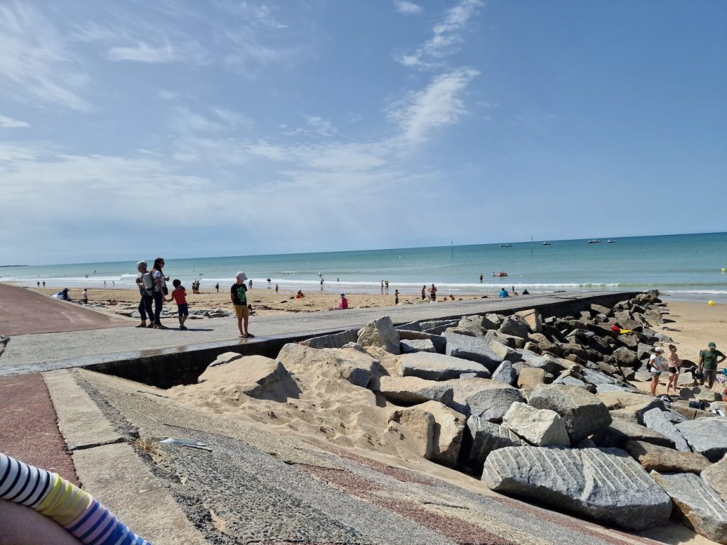
Before having lunch, I took the obligatory seaside photos. This being the height of the French holiday season, the seaside resorts were usually pretty busy in the middle of the day.
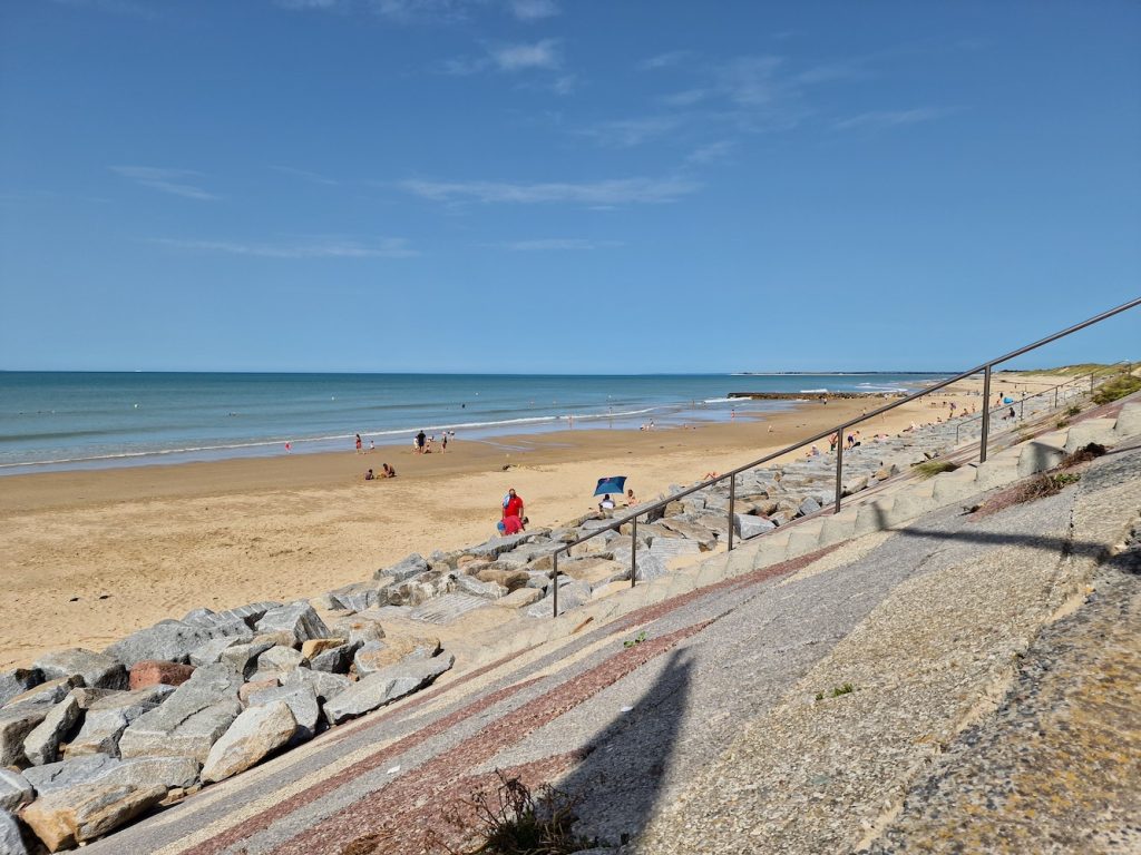
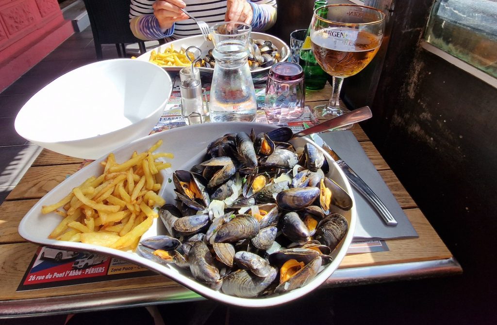
We sat by the window - on the one hand we could keep an eye on the tandem, but on the other it was pretty hot and felt like we were eating lunch in a greenhouse! We both ordered moules and frites. I had a beer, and faced with a choice of 250ml or 500ml, I of course went for 500ml. I had Grimbergen, and when it arrived in its branded glass, it seemed absolutely huge, something of the dimension of a basin. Anyway, it slipped down gratefully! Local moules are one of the objectives of a trip to the seaside, and these were very nice.
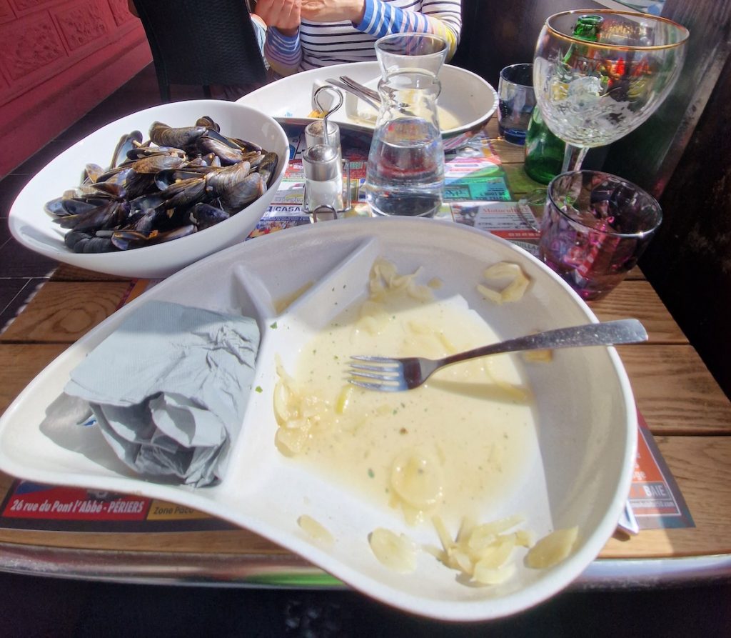
Because of the greenhouse-like conditions in the restaurant, we were quite glad to get outside to ride home, especially as there was a cooling breeze. The return leg was as expected - quite quick for the first half then the sequence of climbs and descents we’re quite familiar with. The climb to Montpinchon itself was pretty tough at that point of the day!
Back at the gite we removed the bags from the bike and parked it under the tarp - heavy rain was forecast for 5am on Thursday so we wanted the bikes under cover as best we could get them. We sat out in the sun for a bit with a beer and crisps. Dinner this evening was the sandwiches I’d made earlier, followed by pear tart.
Thursday 24th August
We were woken just before 6am by a loud and exciting thunderstorm, made more spectacular by happening in the dark before dawn. There was pretty heavy rain while all this was going on, plus the internet cut out until about 7.30am.
As it turned out, the rain (along with rumblings of thunder) persisted until early afternoon, so we didn't do a tandem ride. We made a quick motor excursion to dispose of our recyclable rubbish, and to the supermarket.
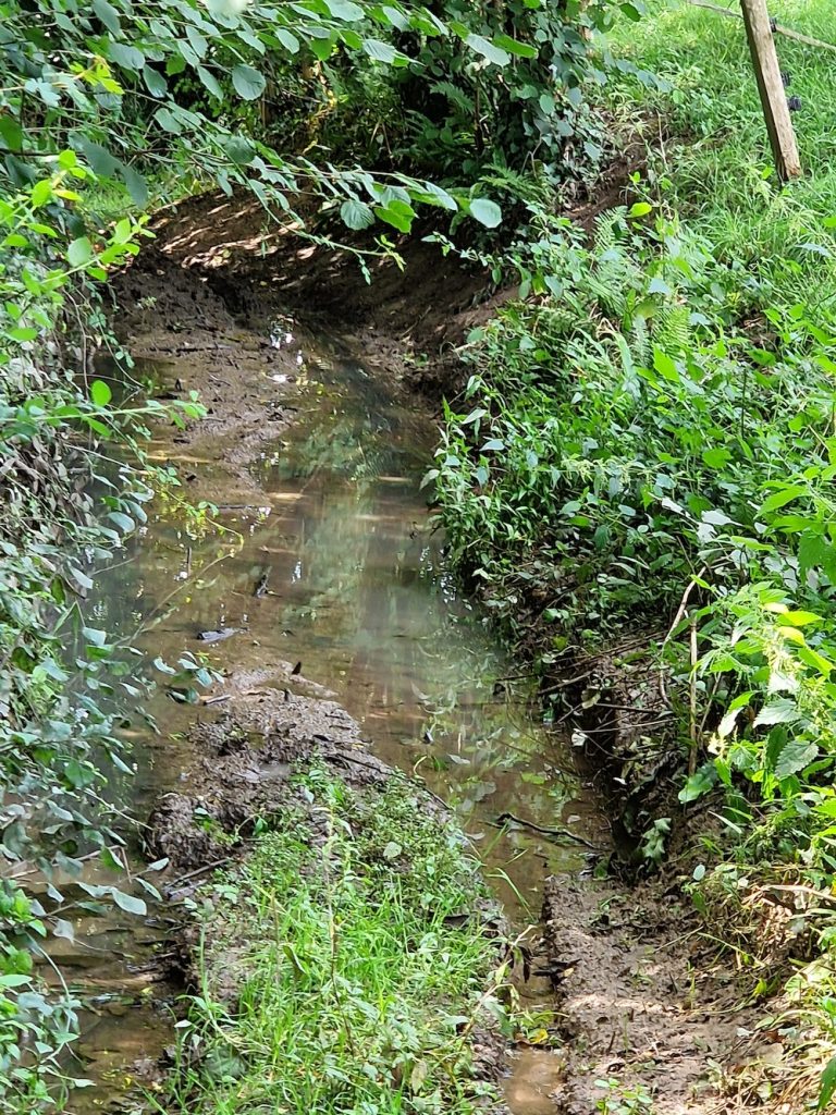
After lunch, we went on a walk exploring some of the lanes near the gite. There are a few published walking routes, but of course quite a lot of these were pretty wet and muddy after several hours of rather heavy rain. It was also very hot and humid which kept the pace a bit low.
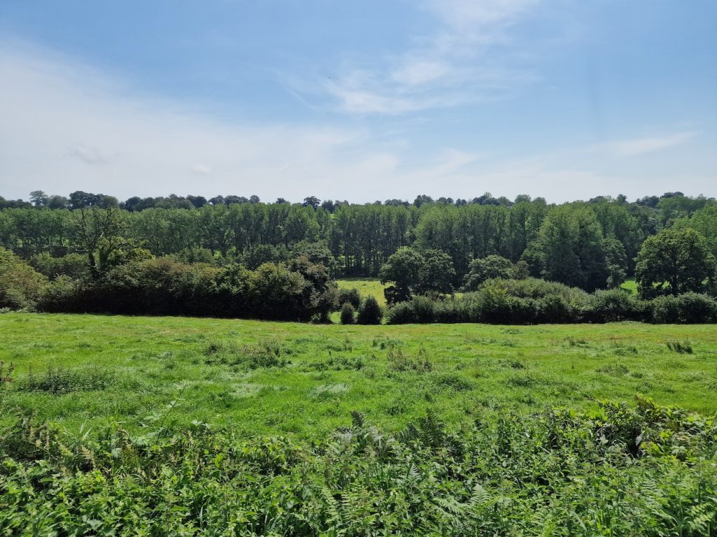
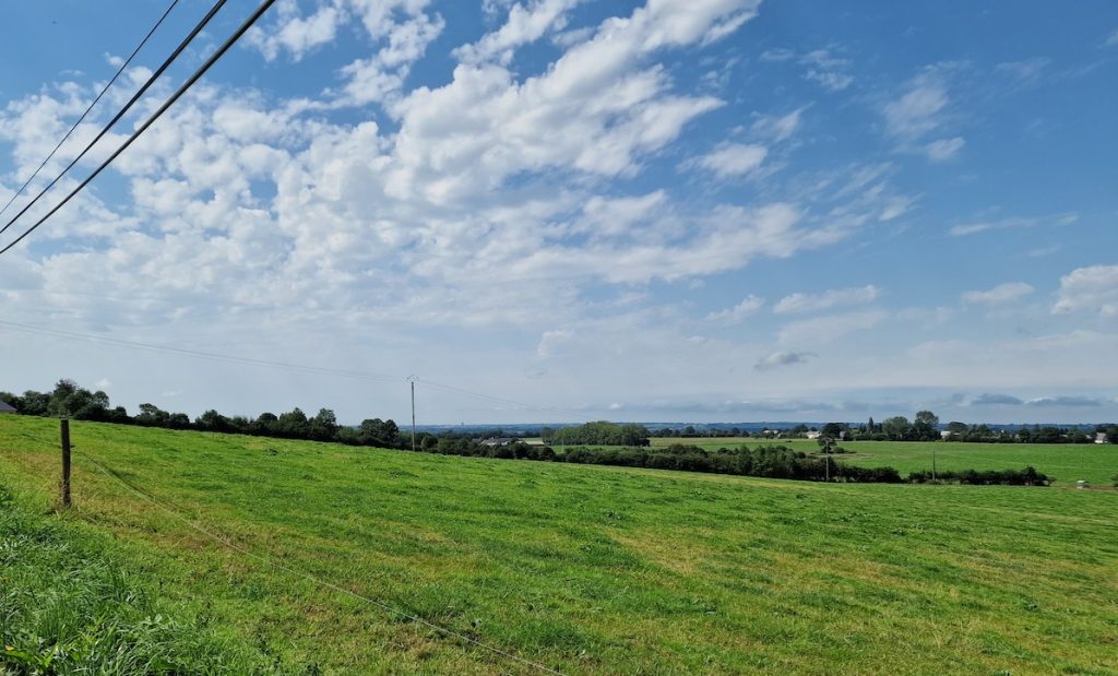
I took a few photographs on this walk - probably more that I usually take while cycling - and these give a good idea of the countryside in which we were staying. We began by walking up to the road and along it for a while. This is the view across the valley near where we were staying.
Most of the recommended walking routes use little farm access tracks like this one. These are the routes that Komoot will use if you've selected one of the off-road options when mapping! This one is particularly delightful and the shade it offered was very welcome.
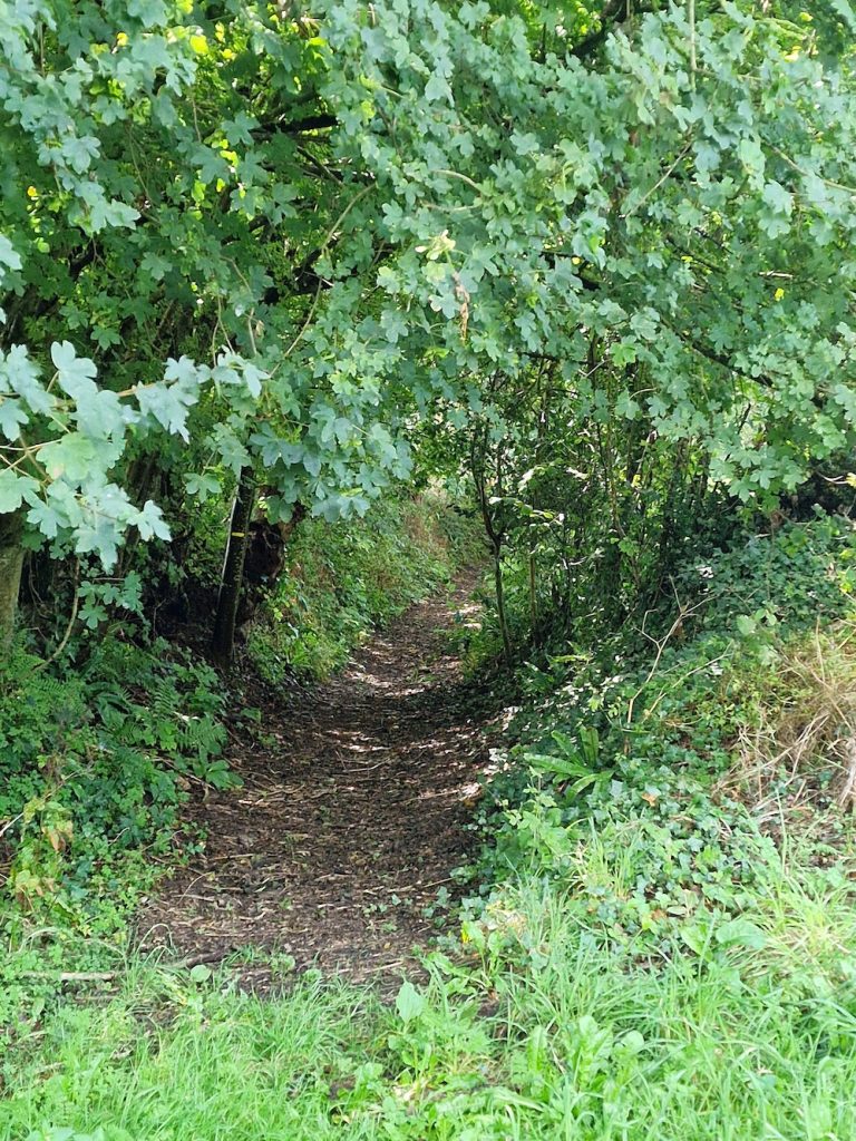
Of course some would have been a bit muddy and wet after the rain!
One thing you notice when staying in the Manche area of Normandy are the many memorials of the D-Day campaign, both official and unofficial. At the bottom of the hill below Cerisy-La-Salle is a monument to the 7 man crew of a Lancaster bomber that came down on the night of 6th June 1944. There is a good account at the Normandy Then and Now website. Regular commemoration services take place as described at the surveyresearch blog site. As well as such "formal memorials", one occasionally comes across more informal memorials. We saw this one, which houses parts from the Lancaster. The bomber was excavated in the 1990s.
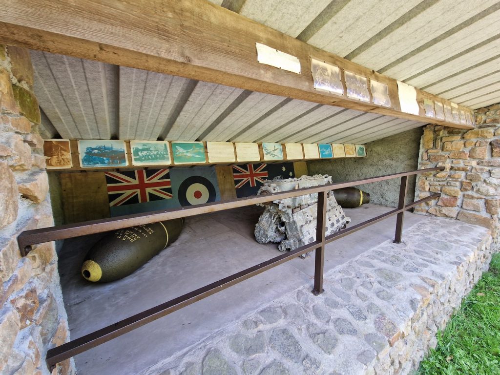
There are a number of A4 printouts above the objects, which illustrate the excavation and fill in some of the details of the bomber's mission and its seven man crew. The surveyresearch blog article sets this in context of the bomber crew's families. What's really quite striking is the commitment of the people of Normandy to remembering the sacrifices of so many young men. If you ever visit the big allied cemeteries you get a sense of the great sacrifices made by a generation.
We walked up to Montpinchon, along the road for a bit before returning to the gite via another farm lane. We'd hoped for some views from Montpinchon, but getting a photo without interfering objects was a little tricky!
Back at the gite, I decided to have a quick ride round the training circuit. This was quite quick, and I recorded my fasted time of the timed section so far: 46:05, despite dropping my minipump and having to stop to retrieve it just as I started the climb back into Cerisy. It was so hot and humid that sweat was pouring off my head in torrents, to such an extent it was operating my touch screen bike computer!
https://connect.garmin.com/modern/activity/embed/11863901525
After that, it was a quiet evening in. We looked at the weather forecast for the next few days to plan out likely cycling excursions.
Friday 25th August
Another sunny day! We decided to drive up to Utah Beach https://en.wikipedia.org/wiki/Utah_Beach and drive along the coast to Barfleur and beyond to the Gatteville lighthouse. The weather forecast suggested some rain later in the day.
This plan involved splitting the tandem for transport, though only to the extent of disconnecting the rear rim brake cable, gear box unit and hydraulic disc brake lever before splitting the frame. With a bit of practice this only takes 5 minutes or so.
Driving to the start of our ride was no problem, and we left the car in the Utah Beach car park. Assembling the tandem was quite quick, though the gearbox needed a bit of attention shortly after setting off.
This is a route we'd previously ridden, and we didn't stop for photos en route. The first half of the ride was very flat and took us past various seaside towns with their associated beaches. Also pretty obvious are many remnants of the the various wartime German defences (the Atlantic Wall), which seem to be pretty indestructible, made of thick reinforced concrete.
The second half of this route took us onto slightly busier roads, though Komoot had (where possible) taken us down quieter sections. On previous visits to Normandy, we'd ridden out to Saint-Vaast-la-Hougue, which sits on a bit of a promontory and appears to be a site of some strategic importance in the past. This time, we bypassed the town and carried on through Barfleur.
Also visible from the coast roads are a variety of small islands, which have also been of strategic importance - you can see evidence of fortifications.
Barfleur was an important port in the middle ages, and was the departure point for William the Conqueror's invasion of England in 1066. It's got a rather charming seafront, but on this occasion we didn't stop. We cycled on to Gatteville-le-Phare, then followed the road almost to the Gatteville lighthouse itself. There appears to be an older lighthouse in addition to the current one.
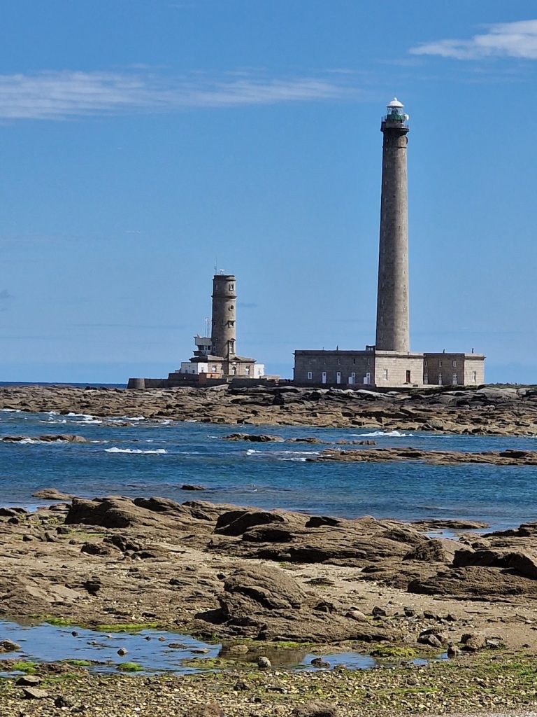
We sat on the rocks by the beach and ate our sandwiches while watching egrets forage in the rockpools.
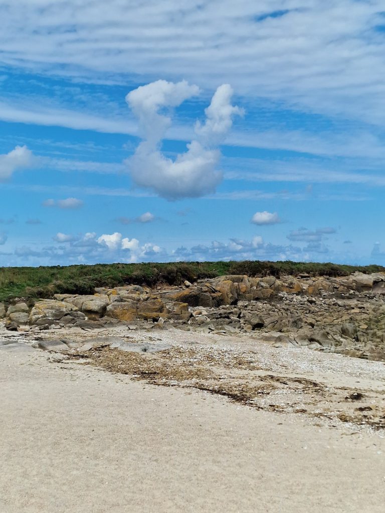
After lunch, we retraced the route (with a lovely tail wind) back to the Utah Beach car park, split the tandem once again and returned to the gite.
Saturday 26th August
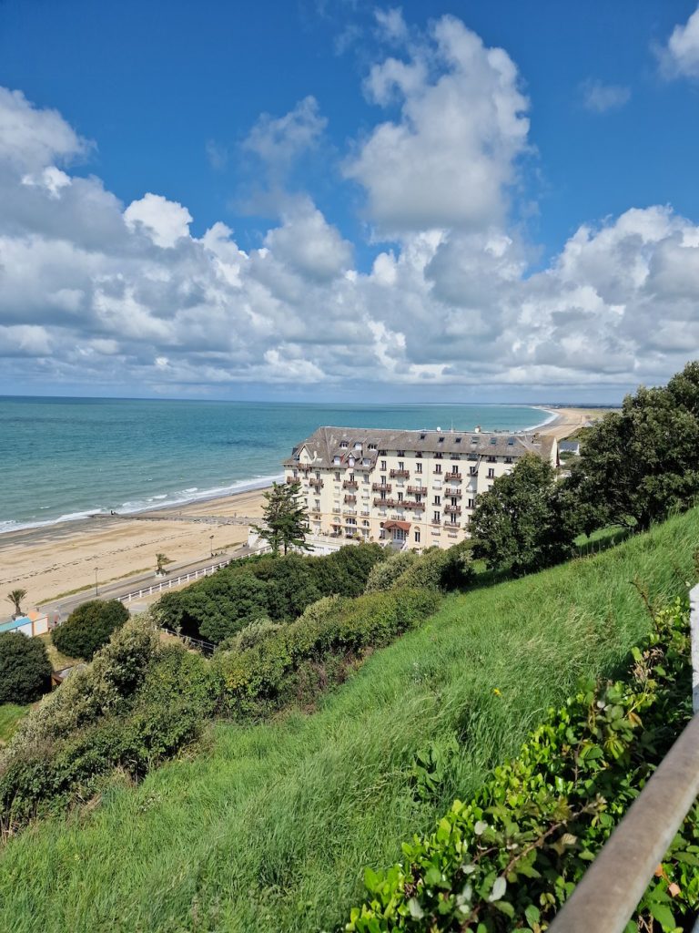
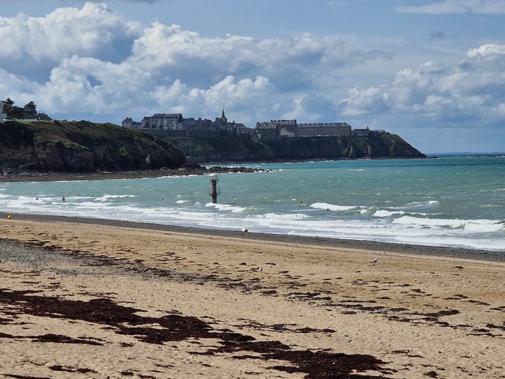
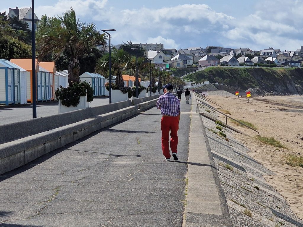
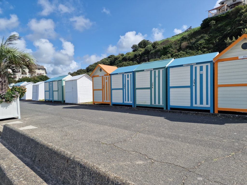
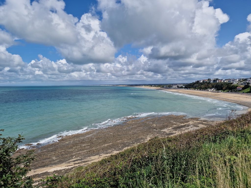
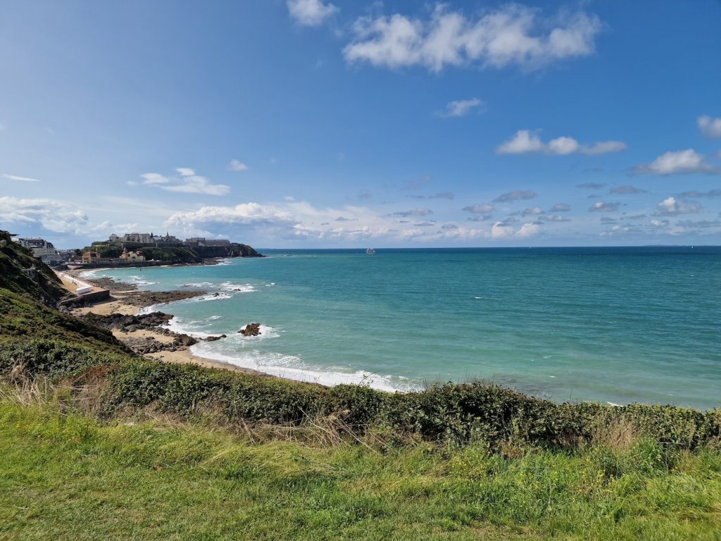
The weather forecast for today was for showers, heavy at times. So we decided to drive over to Granville and do a few touristy sort of things such as buying gifts. In actual fact, even though the first part of the morning was heavily showery near Cerisy-la-Salle, over in Granville it was hot and sunny so a cycling day would have been fine.
So this part of our holiday is mostly a few more seaside photos.
We parked the car in Donville-les-Bains, on the road into Granville itself. We walked down the cliff path to the beach from strand.
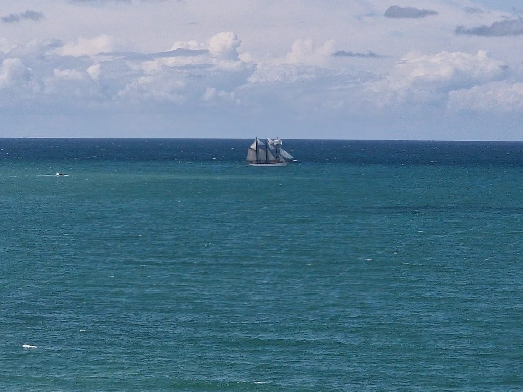
Sunday 27th August
We had another 'iffy' weather forecast, so we had no firm plans for today's activity. However, it seemed to be brightening up, so I got the P3 sorted out and I nipped round the training circuit. This was quite successful as I equalled my fastest timed section, despite a spectacularly heavy (but fortunately brief) rain shower and a load of mud on the road.
After second breakfast, we walked up to the vide grenier in Cerisy. It's always interesting to see the kind of stuff for sale though not much was of interest. The other main attraction is the open air grill these events have. I've developed a love of grilled sausage as this is my favoured post-race lunch at the Duo Normand. So we had grilled saucisse sandwich and frites with lashings of moutarde, which made a fine, if early, lunch. The rain kept going on and off for most of the rest of the day.
Monday 28th August
I started the day with another brisk ride round my training loop on the P3 - pretty uneventful, with a moderate time on the timed section - 45:40. At least it didn't rain on me this time.
The forecast continued to suggest some showers so we decided on a relatively short circuit looping round past the Abbey at Hambye. The route to Hambye took us through the usual rolling Normandy countryside, through Hambye itself, then down a long descent along a road with swooping bends through the woods to the abbey.
The Abbey was founded in the middle of the 12th century and was constructed over the following couple of centuries. The monastery was founded by a group of Benedictine monks. It's located in a thoroughly lovely location.
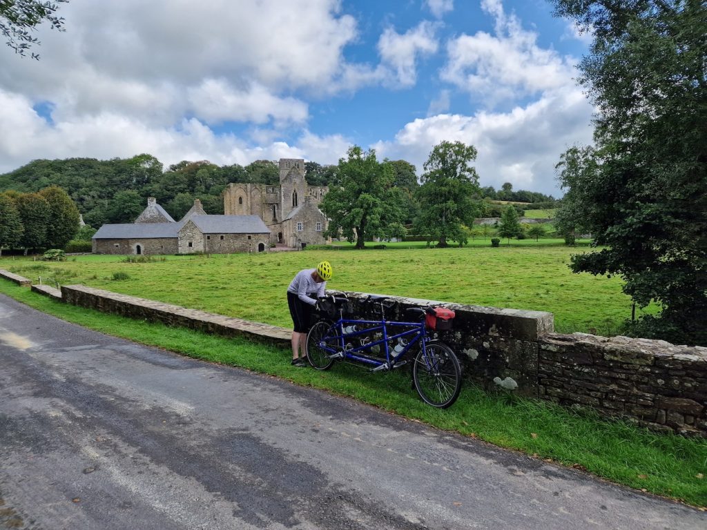
The abbey was apparently in decline from the 13th century, but the final knell came following the French Revolution, when all such establishments became national property, and was sold in 1790. In the following years much of it was dismantled, and the abbey was used as a quarry! It was saved from further decay from the middle of the 20th century, and it's now worth a visit (we'd been a few years ago).
We stopped outside the abbey for an early picnic lunch, before cycling on. This involved the steepest climb of our holiday, clocking in at 14%, as cycled up and out of the valley. At the top of the climb we paused to photograph the panoramic view.
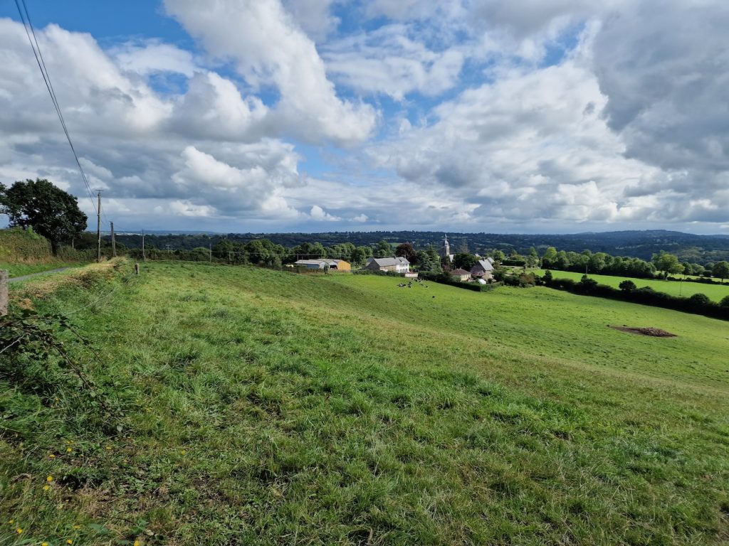
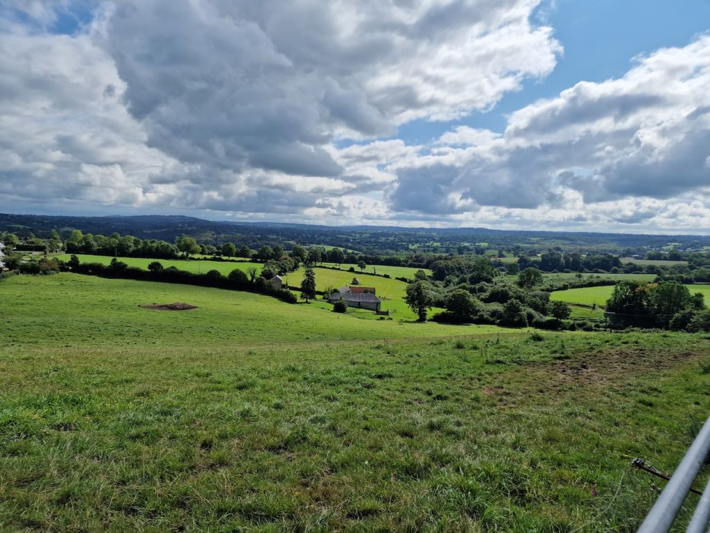
Then it was on to the oddly named La Baleine. Quite why there's a commune named 'the whale' in Normandy is a mystery to me!
We cycled back to the gite, before visiting the large LeClerc supermarket once again.
Our Hambye loop on Garmin Connect
Later on, we watched the third stage of the Vuelta on GCN+.
29th August
This was to be our final day's cycling on our holiday, as our return ferry was to depart at 2pm on the 30th August.
Once again, I prepared baguette sandwiches in case we couldn't find lunch - I also had a couple of pains au raisin for a snack en route.
We decided to drive over to LeMolay-Littry with the tandem and do a ride that circumnavigated Bayeux. The car park at the LeMolay railway station is usually rather empty and is a convenient place to leave the car, and as ever, disassembly and reassembly of the tandem was quite quick.
I'd plotted a route on Komoot which took us on an anti-clockwise route.
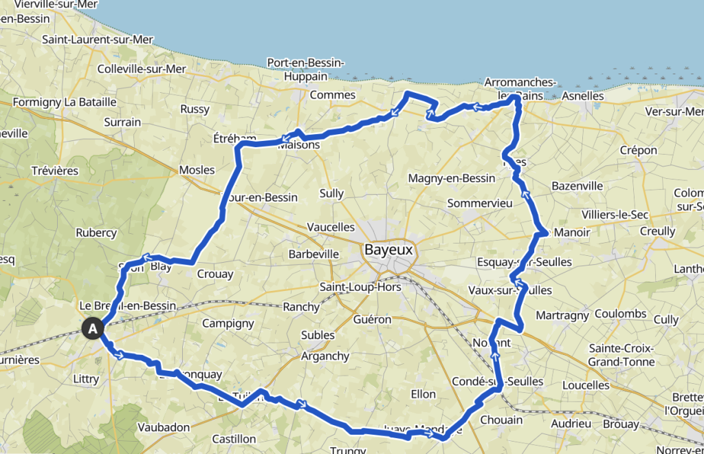
Unfortunately, the directions at the main roundabout in LeMolay (just a few kilometres into our ride) left a lot to be desired, and we had to rely on the Garmin replotting our route. This wasn't too difficult, and in fact was the only major mapping issue we faced. At a couple of other places, the Garmin over-estimated our speed and the display clearly told me to turn at a junction just before the 'real' turn. But by this time, I was a bit wise to this.
Once on our merry way, we found ourselves cycling through the usual Normandy countryside, studded with pretty impressive farm buildings. After a while we rode past an even more impressive edifice, Mondaye Abbey. That link is to the Wikipedia page, which portrays a typically up and down history of such establishments.
Riding on, we were concerned that we might not reach Arromanches in time for lunch, but we managed to get there in time. Just. We stopped at a place called Brasserie Au 6 Juin, Carol had a rather nice looking kebab of scallops and vegetables with rice, while I had sea bream. Very nice. Also a Belgian white lambic from Mort Subite, which went down a treat.
After lunch we went over to look at the beach. Arromanches is the location of Gold Beach, and nowadays is known for the remnants of one of the Mulberry Harbours used for landing materiel in the days and weeks after the D-Day landings.
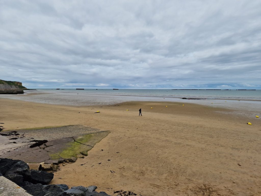
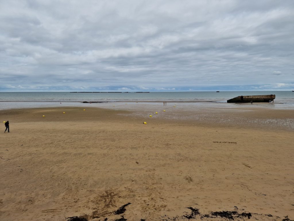
Several parts of the Mulberry Harbour are accessible when the tide is out.
Komoot took us up a quieter route out of Arromanches than we have taken in the past. This is good because there's a steady old climb up from the sea front and it's nice not to worry about holding motorists up as we trundle up at a sedate pace.
Once out of Arromanches, the route took us along the coast, past the famous Atlantic Wall gun emplacement at Longues-sur-mer. We didn't stop there because we were short of time, and we'd visited on a prior trip to Normandy. It's a impressive site - hit by allied bombs on D-Day, the concrete has survived though the emplacements seem to have been lifted bodily from the ground.
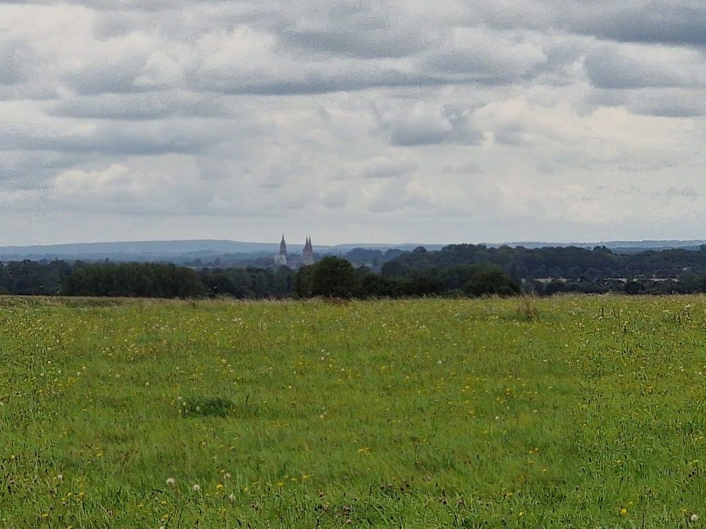
The route back to LeMolay was largely on quiet roads flagged as cycle routes, though on occasion we had to get out of the way of large agricultural vehicles. During this ride, we didn't often catch sight of Bayeux itself - but I think the photo below shows the spires of Bayeux Cathedral. The cathedral houses the wonderful Bayeux Tapestry. It's not actually a tapestry, nor was it made in Bayeux. It was made in England, commissioned by Bishop Odo (William the Conqueror's half-brother). It really resembles a comic strip account of the Norman invasion of England, as seen from the Norman point of view. We visited the cathedral to see the tapestry on a previous visit to Normandy, its well worth it.
After a straightforward run back to the car, we dismantled the tandem, loaded it in the car and drove back to the gite.
When you subscribe to the blog, we will send you an e-mail when there are new updates on the site so you wouldn't miss them.
Comments